RTK drone surveying outperforms traditional methods by mapping vast areas in hours rather than weeks, covering a full square kilometer with high precision in just 3 hours. This digital transformation reduces project delivery times by 80% to 90%, providing engineers and contractors with accurate geospatial data and integrated digital models in record time.
Construction companies in Saudi Arabia face constant pressure to deliver accurate survey reports within tight schedules. However, traditional methods remain a bottleneck, consuming weeks of grueling field and office work. In the fast-paced environment driven by Vision 2030, waiting is no longer an option for ambitious engineers or contractors. This is where RTK drone surveying emerges as a radical solution that redefines efficiency. At Majed Aerial Solutions, we understand that time is the most valuable resource in the construction sector. In this article, we will demonstrate how weeks of ground surveying are transformed into a few hours of flight and digital analysis. We will discuss the time differences with precise figures and the impact of GACA and GEOSA regulatory licenses on execution speed, all while maintaining uncompromising centimeter-level accuracy.
The Time Challenge in the Saudi Construction Sector: Why Traditional Methods Are No Longer Enough
The construction scene in Riyadh and across the Kingdom is witnessing an unprecedented pace of progress, driven by the non-negotiable ambitions of Vision 2030. In this accelerated context, time has become the greatest challenge for both Saudi contractors and engineers. Traditional methods relying on Total Stations can no longer keep up with this momentum. These methods depend on point-by-point measurements, requiring survey teams to be on-site for weeks to cover large areas—a time sink that not only delays design phases but also inflates operational labor costs.
Relying on topographic surveys in Riyadh using manual methods for rugged terrain or massive construction projects puts immense pressure on project timelines. Consequently, there is an increasing demand in the Saudi market for RTK drone survey speed as a strategic necessity to avoid site delivery delays. This fundamental shift bypasses the obstacles of traditional field data collection, as RTK Aerial Survey techniques provide comprehensive and accurate site coverage within hours, ensuring uninterrupted workflow for subsequent phases and giving decision-makers a clear view of the site in record time.
Traditional Surveying vs. RTK Drones: A Field Comparison by the Numbers
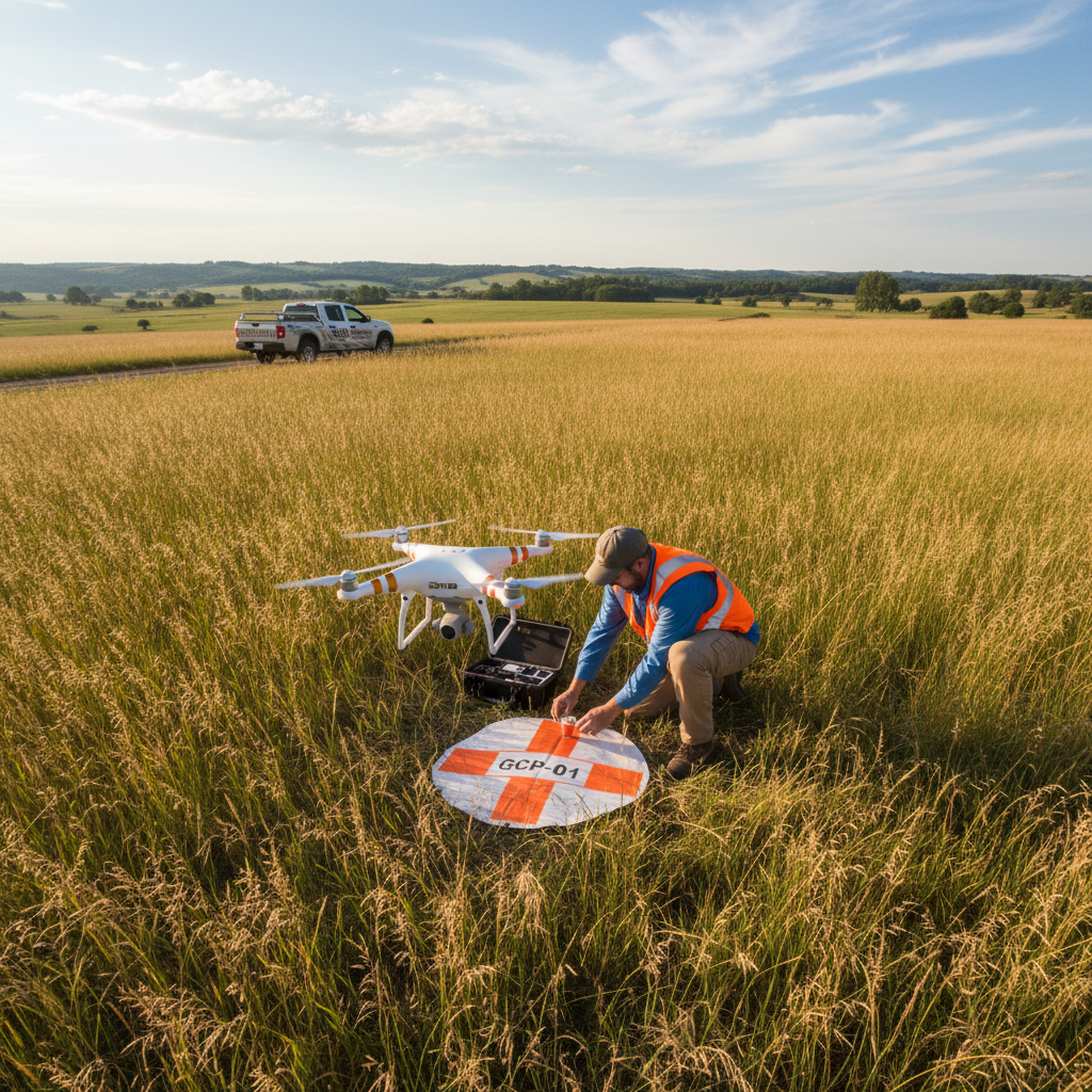
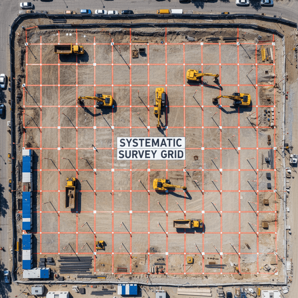
When examining operational efficiency in major construction projects, the gap between traditional methods and modern technology is clear. Traditional survey teams rely on Total Stations that require a surveyor to stand at every point to be recorded. To cover 1 square kilometer, a full team would take two to three weeks of continuous fieldwork, depending on terrain and site obstacles.
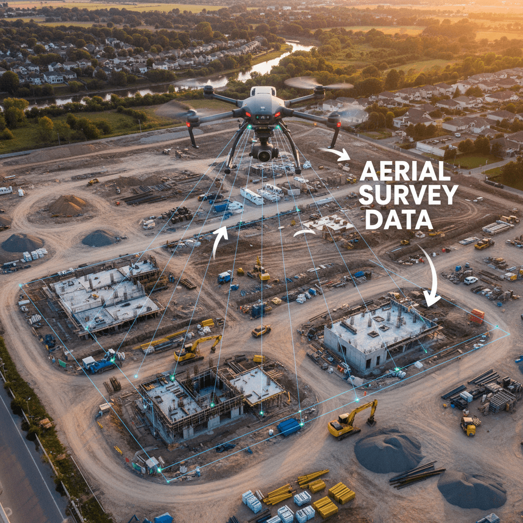
In contrast, our RTK-equipped drone fleet completely changes the equation. An area that requires weeks of physical effort can be covered via RTK Aerial Survey within just two to three hours. This time difference is not just a number; it represents a reduction of over 80% in field time, freeing up human resources for more complex tasks.
The following comparison illustrates the core differences between the two methodologies based on performance data from medium and large-scale projects:
Comparison Factor | Traditional Survey (Total Station) | Drone Survey (Majed RTK Fleet) |
|---|---|---|
Survey Time (1 km²) | 14 - 21 working days | 2 - 3 hours |
Number of Points Captured | Thousands of manually selected points | Millions of points (Point Cloud) |
Field Team Size | 3 - 4 personnel | One operator and one assistant |
Labor Cost | Very high (cumulative) | Low (focused on hourly rate) |
Risk Exposure | High (constant movement on site) | Very low (remote sensing) |
Implementing RTK drone survey speed does more than save time; it directly limits operational risks. Instead of sending survey teams to navigate heavy machinery or unstable terrain for weeks, the drone completes the mission from the air without interfering with construction workflows. This transition from point measurement to comprehensive scanning enhances the quality of Aerial Survey services provided, as every detail on-site is captured rather than relying on sparse samples, providing the contractor with an integrated visual and digital database in a single day.
Fast Office Processing: From Raw Images to Digital Models in Hours
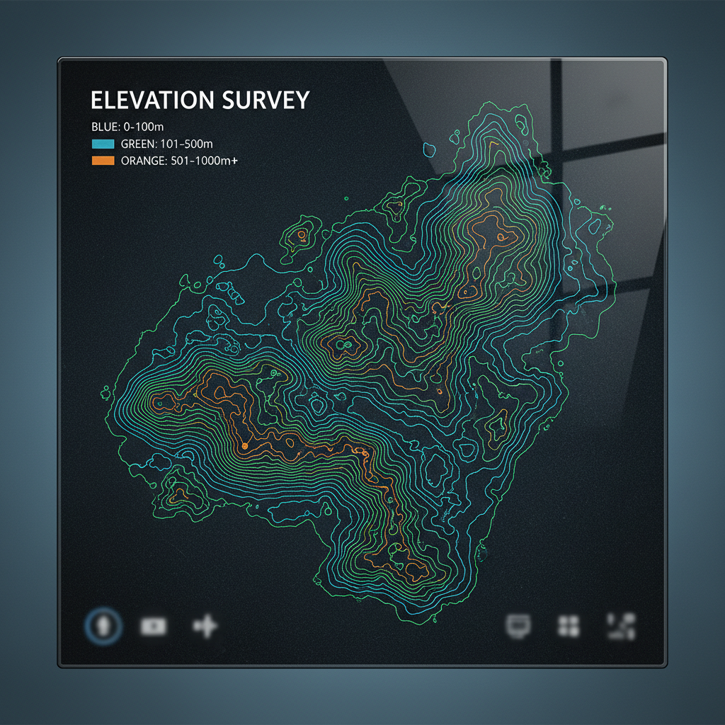
The speed advantage does not stop when the drone lands; it extends to the most complex stage of traditional surveying: office data processing. In traditional methods, surveyors spend long hours manually entering points and correcting human errors from field readings, whereas RTK drone survey speed relies on highly effective automated data workflows from field to office.
The primary advantage lies in reducing reliance on Ground Control Points (GCPs). In projects using standard drones or ground surveys, distributing, fixing, and measuring dozens of GCPs consumes significant time and effort. However, when using RTK Aerial Survey, every image captured by our drones carries precise real-time geographic coordinates with an error margin of no more than 3 cm. This minimizes the need for a large number of control points, limiting their use to final validation and cutting geospatial processing and georeferencing time by more than 60%.
Raw images are quickly transformed into integrated engineering deliverables, including: - High-resolution Orthophotos. - Digital Surface and Terrain Models (DSM & DTM). - Point Clouds and 3D Models.
At Majed Aerial Solutions, we ensure this data is ready for immediate integration into engineering workflows. Deliverables are provided in formats fully compatible with AutoCAD, Civil 3D, and GIS, allowing Saudi engineers to begin design or site analysis within 24 hours of flight completion. This seamless link between aerial data and design software ensures that workflow cycles are not interrupted in topographic surveys in Riyadh projects that require immediate response to field changes.
The Impact of GACA and GEOSA Licenses on Execution Speed in Riyadh
The advantages of RTK drone survey speed go beyond pure technicalities to include regulatory compliance, a critical factor in the capital's strict and fast-paced work environment. Working with an entity officially licensed by the General Authority of Civil Aviation (GACA) and the General Authority for Survey and Geospatial Information (GEOSA), along with authorization from the General Authority for Media Regulation (GAMR), ensures project continuity. These dual licenses allow us to secure flight and field permits efficiently and reliably, protecting contractors and engineers from the risks of sudden work stoppages or legal fines associated with unlicensed operators.
Majed Aerial Solutions' immediate readiness is demonstrated by our professional fleet of 8 specialized drones, completely eliminating delays caused by equipment shortages or failures. For topographic surveys in Riyadh covering vast areas, we have the capacity to deploy multiple flight units simultaneously to ensure data delivery on schedule. This integration of legal coverage and logistical capability ensures that Aerial Survey services starts and finishes according to the planned timeline, making RTK Aerial Survey a safe and fast method that not only saves field time but also protects the project's critical path from administrative hurdles.
Accuracy Without Sacrificing Speed: How We Guarantee ±1 to 3 cm in Record Time
The speed of RTK drone survey speed raises a fundamental question for engineers and contractors: do we sacrifice data quality and reliability to save time? The definitive answer at Majed Aerial Solutions is no; in fact, the opposite is true. Speed here results from the automation and efficiency of data collection, not from cutting corners in quality control. In our projects, we integrate Real-Time Kinematic (RTK) technology with Ground Control Point (GCP) validation as an additional audit reference, ensuring horizontal and vertical accuracy within the ±1 to 3 cm range—the standards required for the most precise infrastructure and major construction projects.
The true technical power lies in the 'data density' factor. While a traditional surveyor provides hundreds or a few thousand manually selected points for a site, Aerial Survey services via our professional fleet provides a 'Point Cloud' containing millions of geospatial points per square meter. This wealth of information provides a high-precision digital representation of every curve, slope, or obstacle on site, giving the design engineer a comprehensive view that leaves no room for guesswork or approximation.
Comparison Factor | Traditional Survey (Total Station) | RTK Aerial Survey (Majed Solutions) |
|---|---|---|
Data Density | Sparse points (limited samples) | Millions of points (full digital representation) |
Terrain Accuracy | May miss gaps between points | Captures the finest topographic changes in real-time |
Rework Risks | Possible due to lack of field data | Virtually non-existent due to comprehensive coverage |
Providing this extreme accuracy in record time directly impacts the efficiency of the engineering design phase. By using topographic surveys in Riyadh deliverables generated from RTK Aerial Survey, contractors or consultants avoid the high costs of 'rework' that typically result from gaps in ground surveys or human errors in individual point recording. We are not just racing against time; we are building a solid engineering database that ensures the accuracy of construction decisions from day one.
Use Cases Requiring High Speed: From Volume Calculations to Project Monitoring
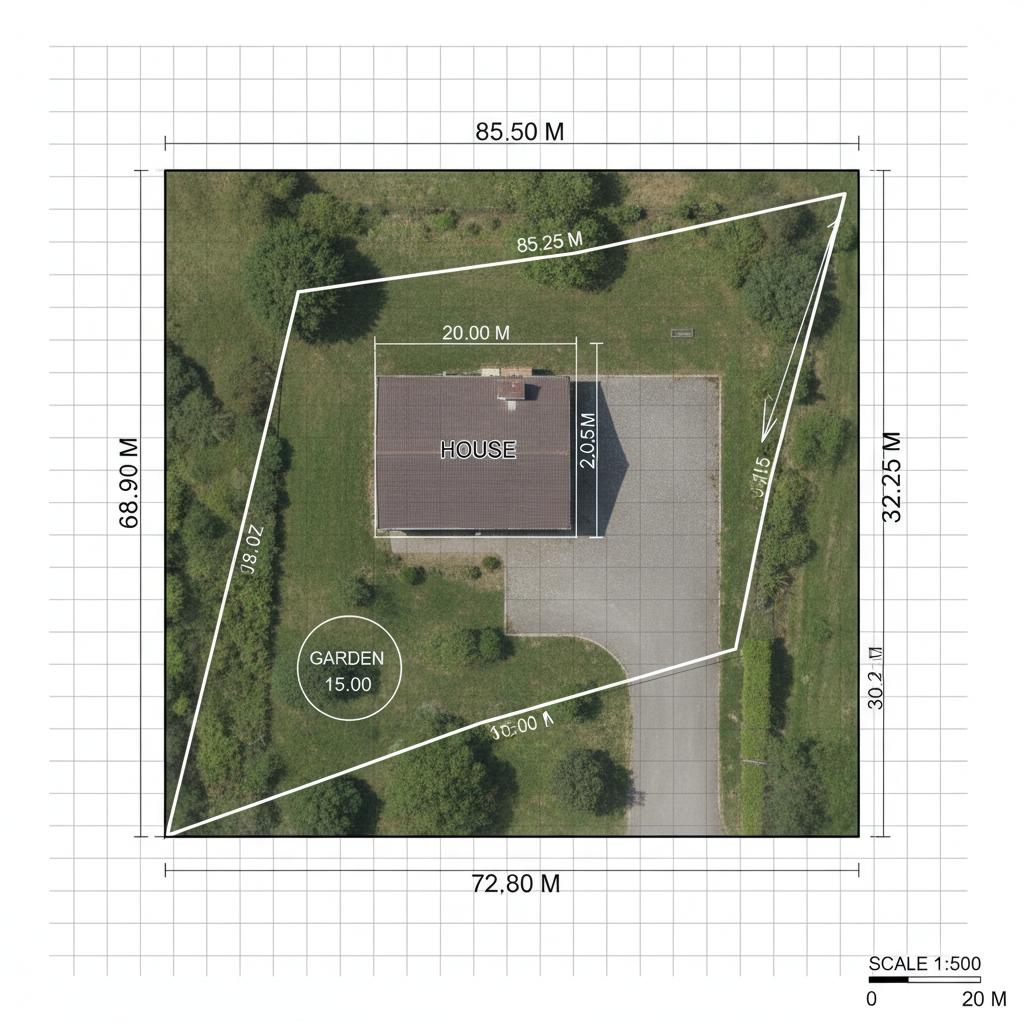
The true value of Majed Aerial Solutions' technology is realized in situations where time equals direct cost, most notably in stockpile volume calculations at major construction sites. While traditional surveyors must climb piles of soil or materials to measure sparse points, our drones capture millions of surface points in minutes, allowing for accurate volumetric reports on the same day as the survey. This type of RTK drone survey speed allows contractors to submit financial claims backed by indisputable visual and digital data, rather than waiting days for approximate estimates from traditional methods.
This speed extends to weekly progress monitoring. In the capital's fast-paced work environment, Aerial Survey services provides periodic updates that allow for centimeter-accurate BIM comparison. A resident engineer or project manager in Riyadh can make immediate construction or financing decisions based on an updated map produced via RTK Aerial Survey, preventing error accumulation or schedule delays.
This methodology at topographic surveys in Riyadh helps transform field data into an effective management tool. Immediate deliverables provide investors and stakeholders with a comprehensive view of the site without the need for constant physical presence, enhancing transparency and improving resource management efficiency in major projects adopting global speed and quality standards.
Conclusion: The ROI of Accelerated Aerial Surveying
Utilizing our professional fleet represents a quantum leap in ROI for major construction projects in the Kingdom. By saving 80% to 90% of the time compared to traditional methods, contractors can significantly reduce operational costs per square meter while ensuring denser, more detailed data that far exceeds limited point samples. The benefit is not only financial efficiency but also the superior technical precision provided by advanced Aerial Survey services.
Implementing RTK drone survey speed has become the new benchmark for excellence and competitiveness in the Saudi construction sector. The integration of centimeter-level accuracy and rapid execution in topographic surveys in Riyadh gives Saudi engineers the tools needed to make precise engineering decisions based on real-time site conditions. This digital transformation via RTK Aerial Survey ensures projects are delivered according to the ambitious timelines of Vision 2030, enhancing resource management efficiency and avoiding costly field delays.
In conclusion, adopting RTK drone technology represents a radical shift in the efficiency of construction projects within the Kingdom, saving time and effort far beyond traditional methods. If you seek to enhance data accuracy and shorten delivery periods, engaging specialized experts ensures you maximize the benefits of these innovative technologies. At Majed Aerial Solutions, we are dedicated to helping our partners achieve the most accurate results. You can always see how we execute integrated aerial survey operations aimed at transforming field challenges into reliable digital data that supports your engineering decisions with confidence.