Business logo
3D Aerial Surveying

Centimeter-accurate aerial photogrammetry for your projects

We capture precise aerial data with GCP field verification to ensure your project designs are built on a solid foundation in Riyadh and throughout Saudi Arabia.

Drone performing an aerial photogrammetry survey over a construction site
Our Credentials

We don't just promise precision—we prove it with licensing.

The numbers speak for themselves: a full drone fleet, GACA and GEOSA licensing, and a proven track record of successful projects nationwide.

3

Operational Licenses

We hold GACA and GEOSA licenses, along with a GAMR permit for media and production.

8

Professional Aircraft

A versatile fleet of RTK-enabled, imaging, and thermal platforms ensuring mission continuity.

100+

Completed Projects

Comprehensive survey, modeling, and inspection projects across Riyadh and all regions of Saudi Arabia.

±1-3 cm

Centimeter-Level Accuracy

Survey-grade accuracy verified by Ground Control Points (GCPs).

Why Use Drones?

Looking for Precision and Reliable Deliverables?

Aerial photogrammetry provides RTK accuracy of ±1-3 cm, BIM/GIS-ready outputs, and faster turnaround than traditional methods—all at a lower cost.

01

±1-3 cm Accuracy

We combine RTK technology with field-verified GCPs for every project to deliver data you can trust.

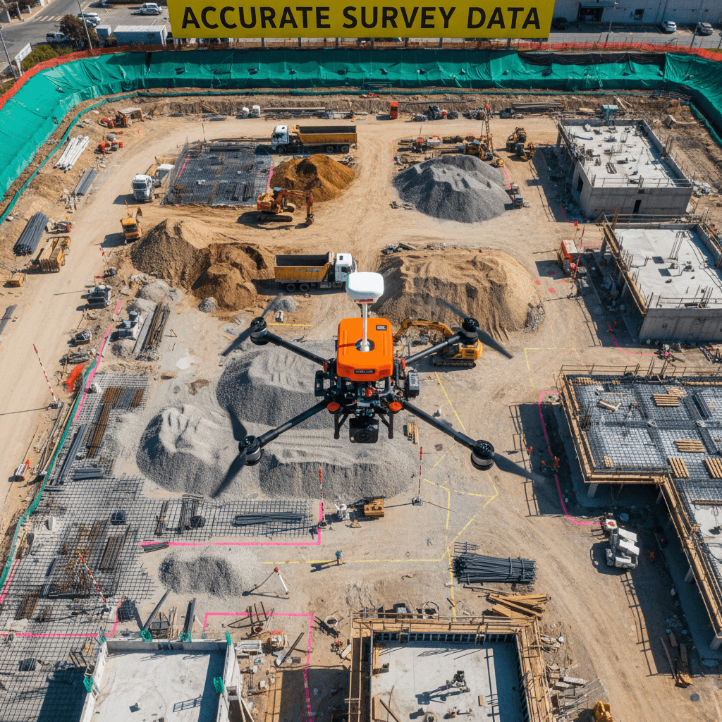
RTK-equipped drone performing a precision survey over a construction site.
02

BIM & GIS Ready Deliverables

We deliver files compatible with Revit, AutoCAD, and ArcGIS, integrating seamlessly into your existing workflow.

03

Accelerated Turnaround

Cover large-scale sites in record time, delivering actionable data in days rather than weeks.

04

Significant Cost Savings

Reduce total survey costs through smaller crews, less equipment, and fewer site visits.

3D terrain model of a construction site displayed on a computer screen in a modern office.
Practical Applications

From Site Monitoring to Digital Twins

We transform aerial data into actionable insights for construction sites, accurate volume reports, and ready-to-use digital assets.

Drone flying over an active construction site with cranes and excavation work.

Scheduled aerial missions to document construction phases and compare as-builts against plans with 1-3 cm precision.

General FAQ

Clear answers before you begin

Direct answers regarding survey deliverables, accuracy, timelines, and licensing.

Overhead aerial view of a drone performing a photogrammetry mission at an open site.

Over 100 Successful Aerial Surveys Across the Kingdom

Contact us today for a free quote and a sample of data from projects similar to yours. Request a consultation or call us directly at +12345678900.

Aerial Photogrammetry | المسح التصويري الجوي

Aerial Photogrammetry Services in Riyadh and Saudi Arabia

Majed Aerial Solutions provides professional drone-based aerial photogrammetry and mapping services in Riyadh and across Saudi Arabia. The service is designed for construction, infrastructure, surveying, engineering, GIS, earthwork, progress monitoring and digital-twin applications.

What we provide

  • RTK aerial photogrammetry
  • Ground Control Point (GCP) verification
  • Orthomosaic mapping
  • Digital Surface Models (DSM)
  • Digital Terrain Models (DTM)
  • 3D photogrammetric models
  • Point clouds
  • Contour generation
  • Topographic mapping
  • Construction progress mapping
  • Earthwork and quantity measurement support
  • GIS-ready aerial datasets

Typical deliverables

Depending on project requirements, aerial survey datasets can be delivered in formats suitable for engineering, GIS, CAD, photogrammetry and 3D processing workflows.

  • Orthomosaic
  • DSM
  • DTM
  • Point cloud
  • 3D mesh / textured model
  • LAS / XYZ / PLY
  • DXF
  • SHP
  • Contour data
  • Geo-referenced imagery

Applications

  • Construction site surveying
  • Infrastructure projects
  • Road and highway monitoring
  • Earthworks and excavation
  • Stockpile and volume calculations
  • Construction progress monitoring
  • Land development
  • Topographic mapping
  • GIS data collection
  • Digital twins and 3D site documentation
  • Real-estate and development documentation

Operational coverage

Services are available in Riyadh and other locations throughout Saudi Arabia, subject to applicable aviation, site-access and operational requirements.

Majed Aerial Solutions operates professional DJI aerial platforms, including RTK-capable systems, for mapping, imaging, inspection and surveying applications.

What is aerial photogrammetry?

Aerial photogrammetry is a surveying and mapping technique that uses overlapping photographs captured from an unmanned aircraft system (UAS/drone) to generate measurable geographic and three-dimensional information. Photogrammetric processing can produce orthomosaics, point clouds, digital surface models, digital terrain models, contours and 3D models.

المسح التصويري الجوي هو تقنية للمسح ورسم الخرائط تعتمد على التقاط صور جوية متداخلة باستخدام الطائرات بدون طيار، ثم معالجة الصور لإنتاج بيانات جغرافية وقابلة للقياس مثل الأرثوموزايك، السحب النقطية، نماذج الارتفاعات الرقمية، نماذج التضاريس، خطوط الكنتور والنماذج ثلاثية الأبعاد.