

Aerial Surveying with ±1–3 cm Accuracy
High-Precision RTK Aerial Surveying
RTK drone surveying delivering ±1–3 cm accuracy, backed by rigorous GCP validation. Our standard deliverables include Orthomosaic GeoTIFF, DTM, DSM, classified LAS/LAZ point clouds, and DXF files — fully compatible with AutoCAD, ArcGIS, and Revit BIM environments.

Digital Maps & Models
10–50 cm contour intervals, Orthomosaics, DTM, and DSM.

Ready for Direct Import
Fully compatible with AutoCAD, ArcGIS, and Revit BIM.
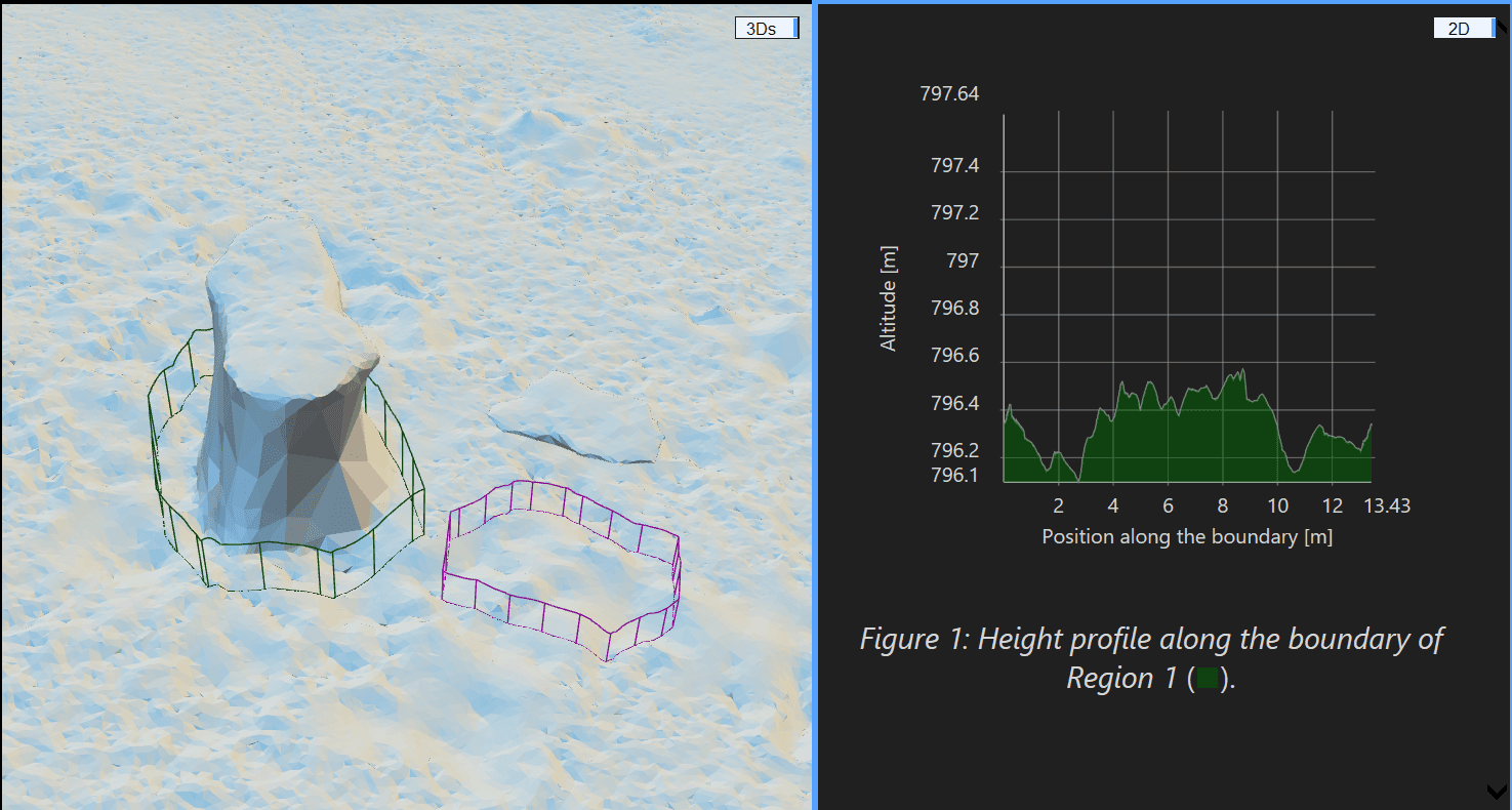
Auditable Data
Engineering accuracy report included with every project.

Scalable Coverage
Up to 100 hectares mapped in a single field day.

Comprehensive Survey Reports
Technical reports detailing methodology, measurement accuracy, and GCP (Ground Control Point) locations.
Precision Aerial Survey Pricing
Choose the plan that fits your project scale and receive high-accuracy geospatial data with guaranteed quality.
Small Project
Custom
Site-SpecificAerial survey for limited areas with ±3 cm accuracy and full GCP processing.
Up to 20 Hectares
GCP Processing & Verification
Detailed Final Report
CAD & GeoTIFF Files
Medium Project
Custom
Site-SpecificComprehensive survey for mid-sized areas with ±1-3 cm RTK accuracy and 3D modeling.
20-100 Hectares
Full 3D Modeling
High-Precision RTK
Advanced Processing
Multi-Format Delivery
Dedicated Technical Support
Large Scale Project
Custom
Flexible ContractContinuous comprehensive survey for large-scale areas with multi-service integration and periodic monitoring.
Over 100 Hectares
Integrated Multi-Services
Regular Periodic Monitoring
Integrated GIS Solutions
Dedicated Project Team
Ready for Professional-Grade Aerial Surveying?
Contact the Majed aerial solutions team to transform your project into precise, actionable geospatial data.
Request Your Topographic Survey Today
Send your project details via the form, and we will provide a technical proposal and execution plan within 24 business hours.
Phone
+966 55 997 7170 | +966 55 678 1524
Address
2353 Ali Ibn Muhammed Albatalusi, Tuwaiq, Riyadh 14927, Kingdom of Saudi Arabia
Get directions