
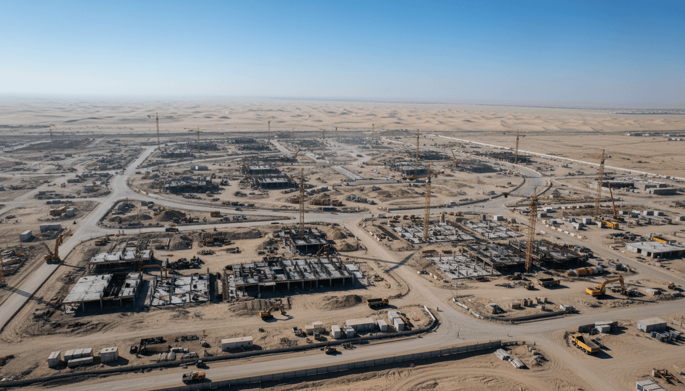
المسح الدوري لمشاريع الإنشاء بدقة سنتيمترية
مسح جوي دوري كل أسبوعين أو شهرياً لتوثيق التقدم الميداني، حساب كميات الحفر والردم، ومقارنة الواقع بالمخطط — بدقة ±1–3 سم تُسلَّم في صيغ متوافقة AutoCAD وRevit BIM.
لماذا تحتاج مشاريع الإنشاء إلى مسح جوي دوري؟
البناء ليس مجرد مراحل، بل إرث يُبنى على مدى أشهر أو سنوات. اللحظات الهندسية الفارقة — من صب الأساسات إلى اكتمال الهياكل وحتى اللمسات النهائية — تختفي مع تقدم العمل. التوثيق الجوي الدوري لا يحفظ هذا السجل فحسب، بل يضمن بقاءه مرجعاً بصرياً موثوقاً قبل أن يندثر.
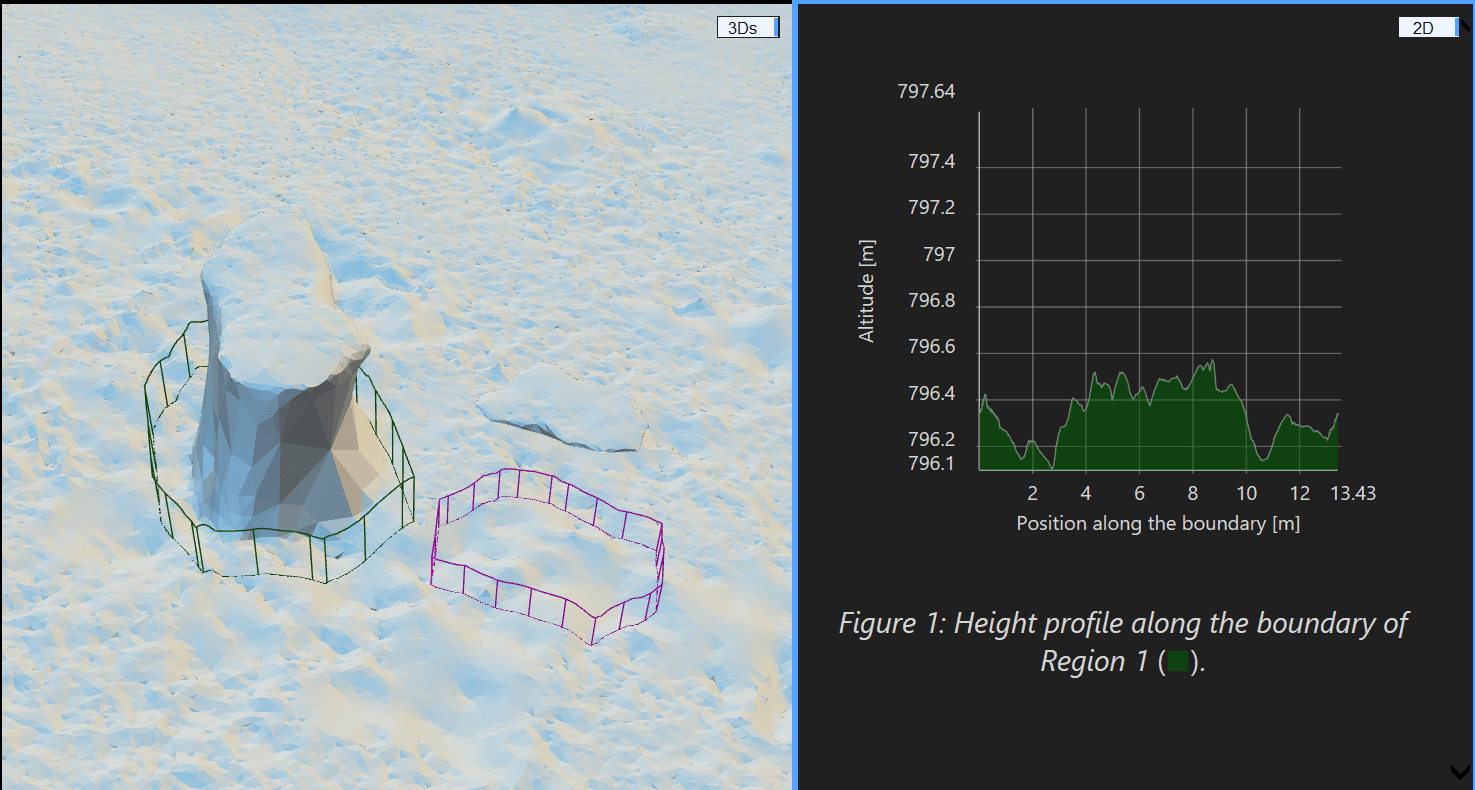
سجل مرئي موحّد بدقة سنتيمترية لكل مرحلة من مراحل المشروع.
سجل مرئي موحّد بدقة سنتيمترية لكل مرحلة من مراحل المشروع.
حلول جوية متكاملة لقطاعات متعددة
نقدم خدمات المسح الجوي المتخصصة باستخدام أحدث تقنيات الطائرات بدون طيار لضمان دقة عالية ونتائج موثوقة في جميع المشاريع.
للملاك والمطورين
دورة توثيق بصري دورية تُشكّل سجلاً موثوقاً لاستثمارك، مرجعاً استراتيجياً لمجالس الإدارة والشركاء، وأصلاً قيّماً يدعم عمليات التخارج وإعادة التطوير المستقبلية.
للتسويق والاتصال المؤسسي
محتوى احترافي جاهز للنشر والعروض التقديمية، يتجدّد تلقائياً مع كل زيارة دون الحاجة إلى جلسات تصوير وتنسيق منفصلة.
للمقاولين والموردين
توثيق أعمالكم الميدانية بدقة وتاريخ، مرجع للتسليم والاستلام مع المقاول الرئيسي، وحماية موقفكم في حال المراجعات.
اختبر بنفسك دقة ±1-3 سم
راسلنا عبر النموذج أو اتصل مباشرة. نرد على استفسارات مشاريع الإنشاء خلال يوم عمل واحد في الرياض وجميع مناطق المملكة.