Drone Survey & Mapping
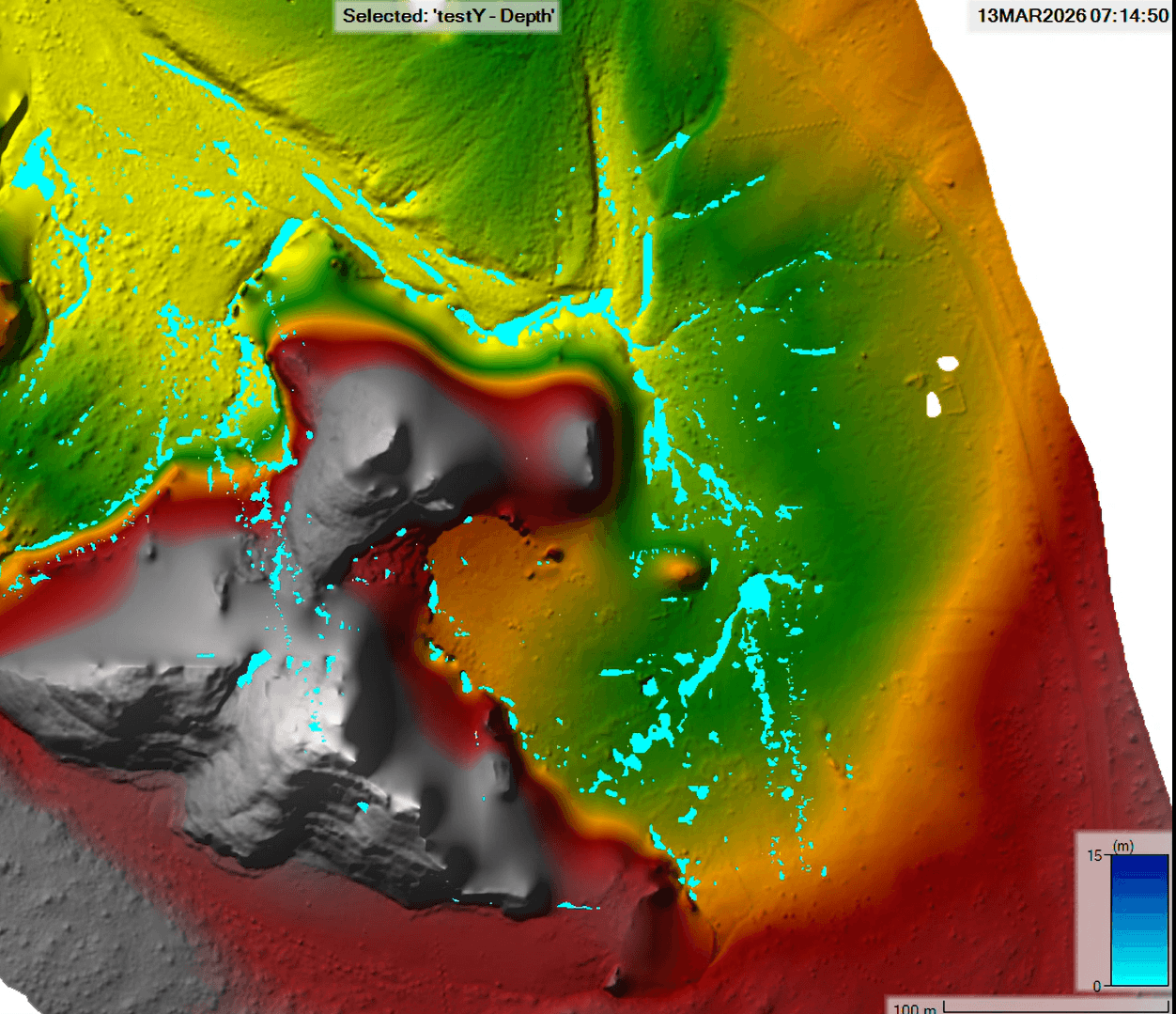
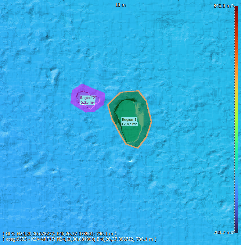
RTK aerial mapping, orthomosaic, DSM, DTM, contours, point clouds, CAD/GIS deliverables, and project-ready survey outputs.
View Drone Survey Services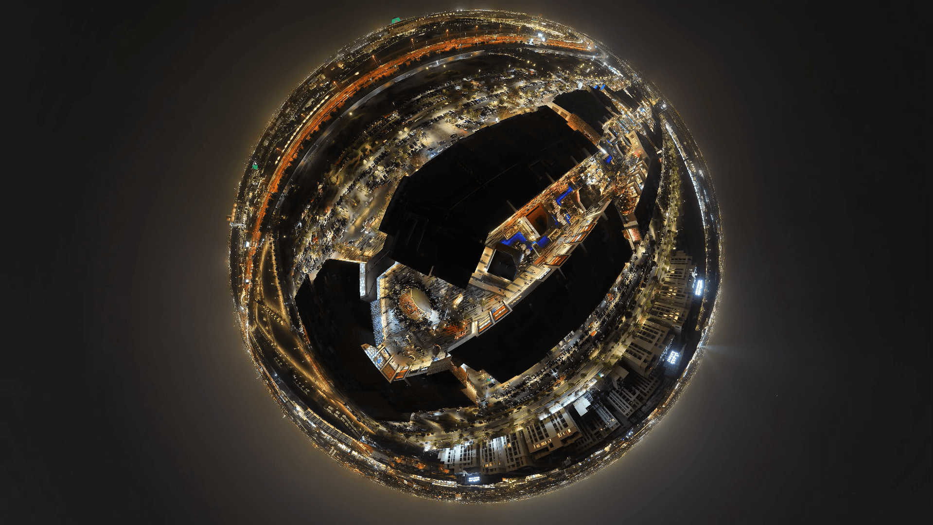
We deliver specialized drone services across Riyadh — from 6K high-resolution videography and RTK precision mapping to thermal inspections and live aerial broadcasting, built for engineering and construction projects.
We deliver high-precision drone services built for construction, engineering, and industrial projects across Riyadh and the wider region.
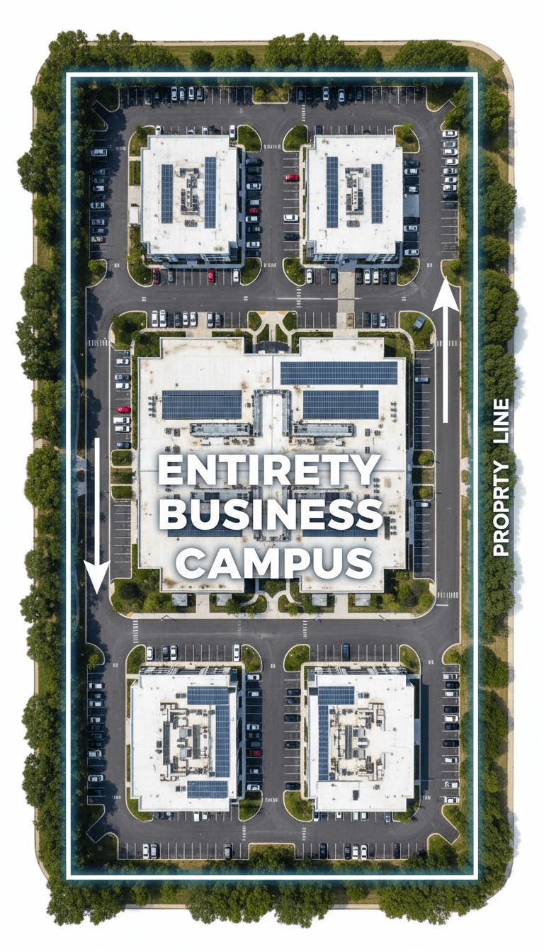
Cinematic 6K aerial videography engineered for large-scale developments, architectural documentation, high-caliber professional productions, and live events.
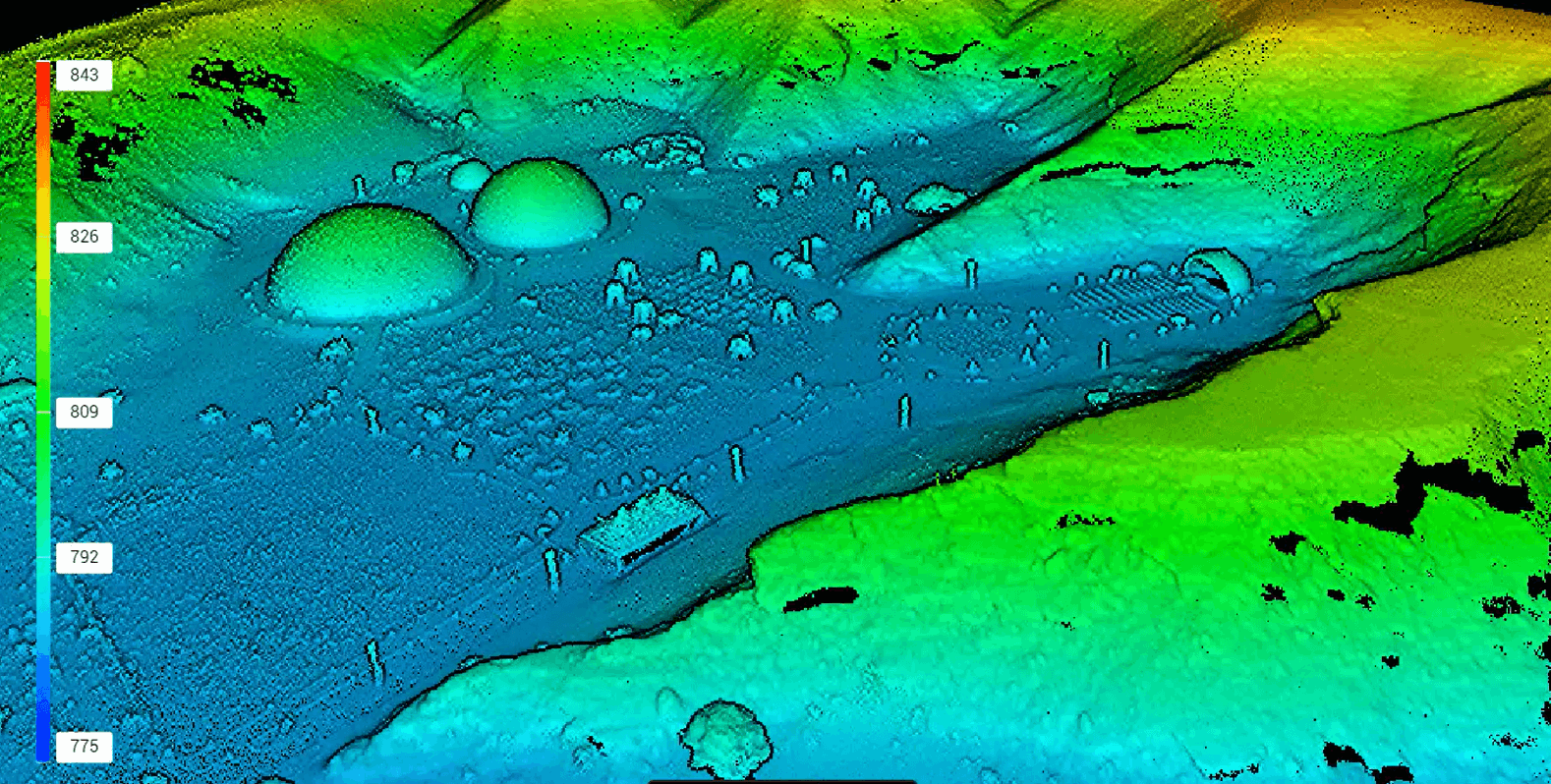
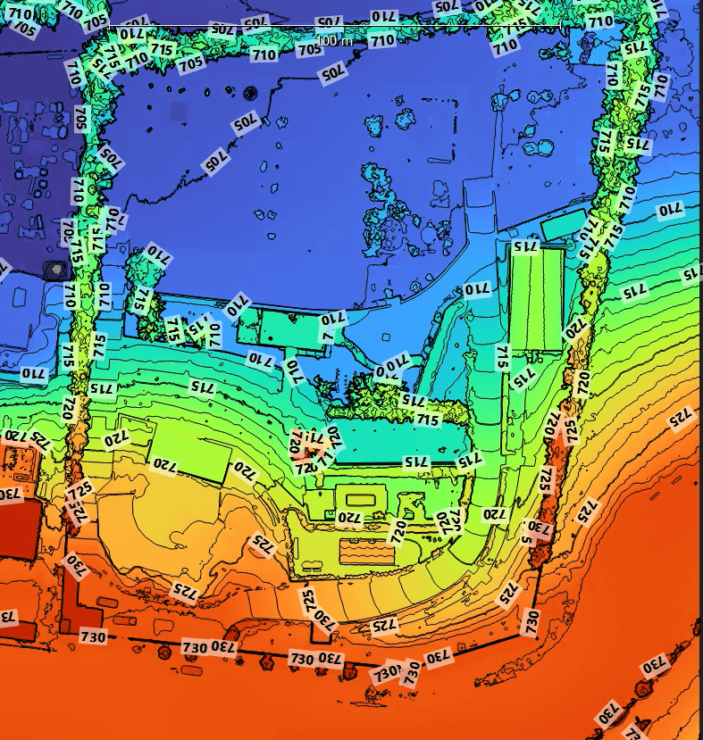
RTK-powered mapping built for land surveying, site planning, and GIS and BIM-ready datasets.
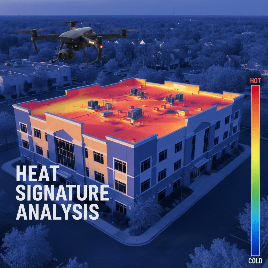
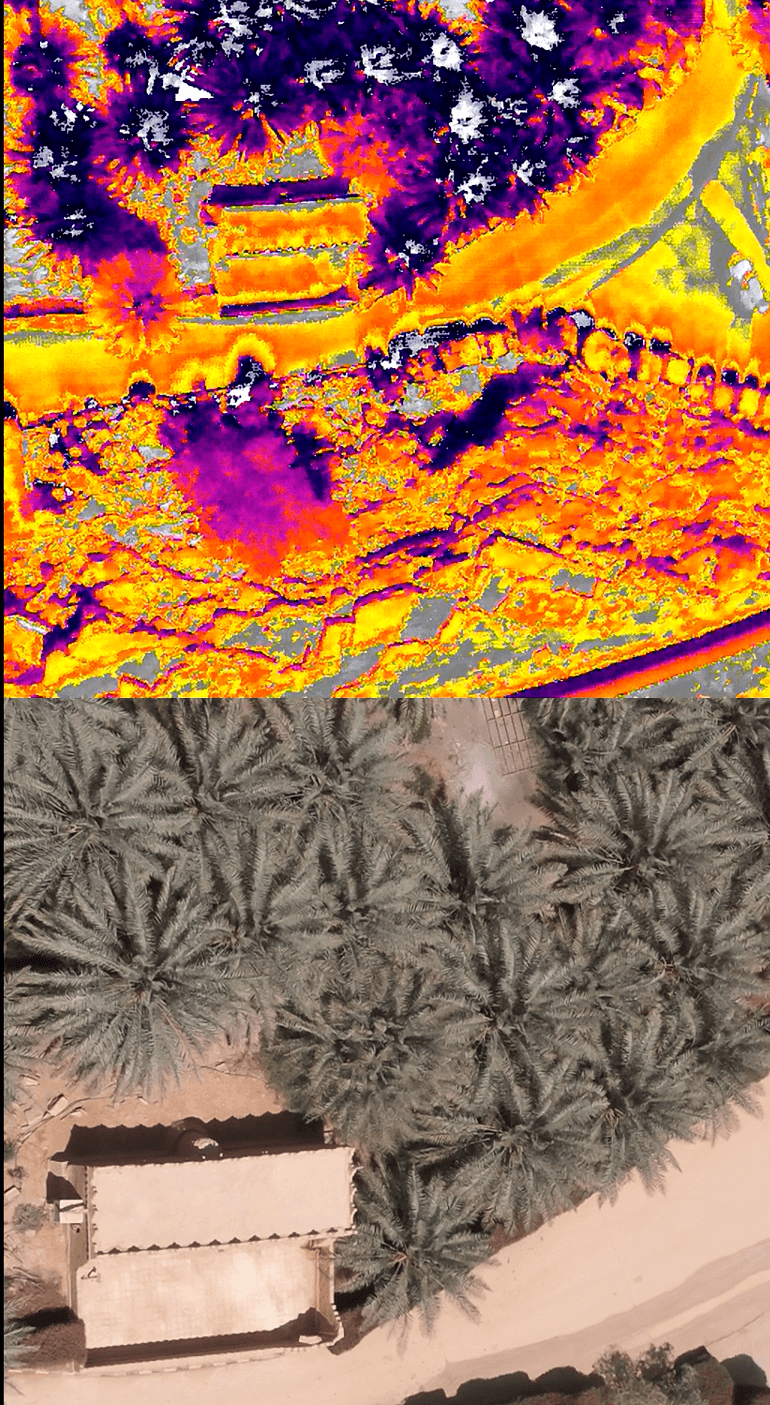
Advanced thermal inspections to evaluate insulation performance and detect hidden issues across infrastructure and buildings.
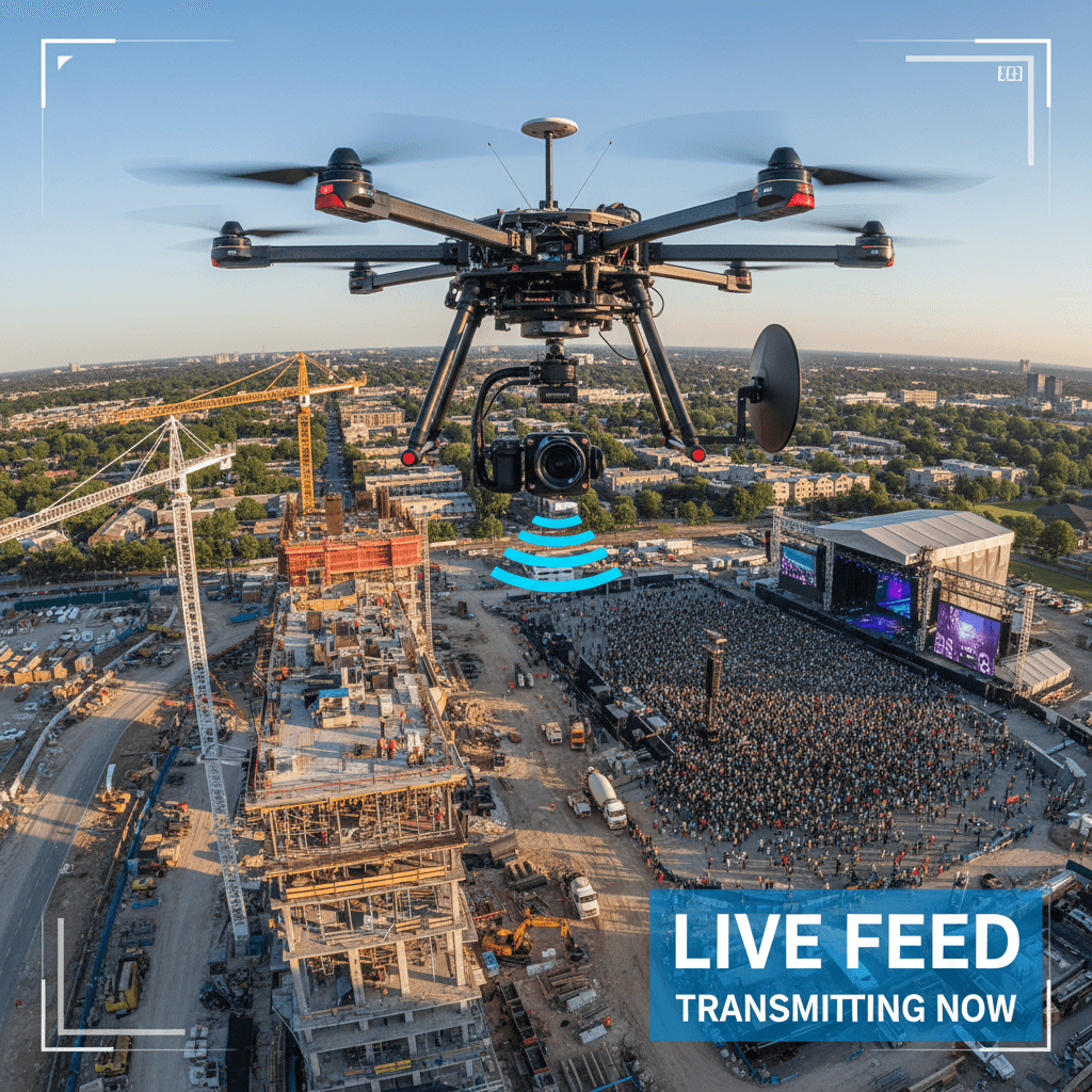
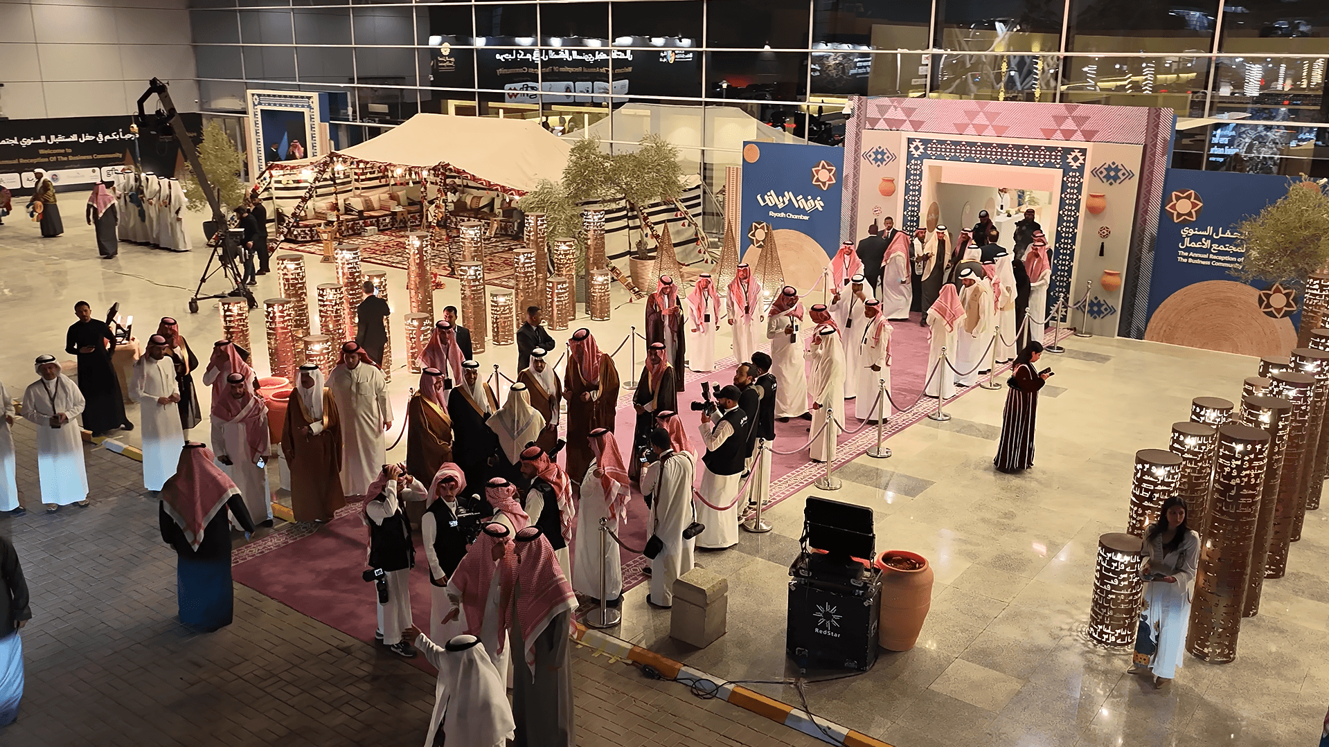
High-quality live aerial broadcasting for events, projects, and real-time presentations.
High standards of precision and geographic coverage for every project across Saudi Arabia.
6K
Cinematic 6K Video Precision for Crystal-Clear, True-to-Life Detail
2cm
RTK Precision Positioning for Survey-Grade Mapping Accuracy
100%
Certified and Fully Compliant with Saudi General Authority of Civil Aviation Standards
SA
Serving clients across Saudi Arabia, with operations based in Riyadh and extending throughout the region.
Explore our real project portfolio: 6K construction site videography, centimeter-accurate RTK mapping, thermal inspections, and industrial surveys.
Schedule a Complimentary Consultation. Our team evaluates your project requirements in depth and delivers a precision-engineered aerial solution aligned to your exact specifications.
Majed Aerial Solutions provides professional drone services in Riyadh and across Saudi Arabia, including aerial photography, drone videography, RTK mapping, topographic survey, thermal inspection, multispectral agriculture analysis, construction progress monitoring, and industrial asset inspection.
RTK aerial mapping, orthomosaic, DSM, DTM, contours, point clouds, CAD/GIS deliverables, and project-ready survey outputs.
View Drone Survey ServicesVisual, zoom, and thermal drone inspection for construction, utilities, telecom towers, roofs, solar sites, and industrial assets.
View Inspection ServicesProfessional aerial content for real estate, construction, events, tourism, marketing, sports, and corporate projects.
View Aerial PortfolioThermal inspection and multispectral agriculture data for farms, compounds, infrastructure, solar panels, and vegetation analysis.
View Thermal & Agriculture SolutionsDaily updates, technical notes, project insights, and field-based articles about drone survey, aerial photography, inspection, mapping, GACA-compliant operations, and aerial data workflows in Saudi Arabia.
Daily Blog
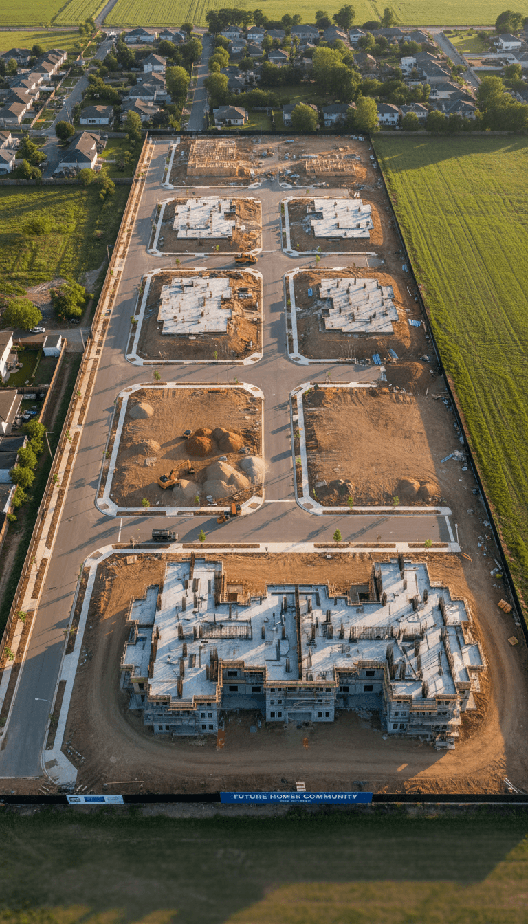
Drone mapping reduces site documentation time, improves visual progress tracking, and provides orthomosaic, elevation, and CAD-ready data for engineering teams.
Read ArticleDaily Blog
Thermal and zoom-capable drones help inspect roofs, towers, solar panels, compounds, and industrial assets without unnecessary access risks.
Read ArticleDaily Blog
High-resolution drone photography improves real estate presentation, construction documentation, and marketing visibility across digital platforms.
Read ArticleCreate these as separate Durable pages, not only one page: