Our drone-based earthworks quantity surveying solution protects Saudi construction budgets by delivering volumetric accuracy between 1% and 3% for excavation progress and billing verification. By comparing high-resolution 3D terrain models with design surfaces, developers can detect discrepancies early, ensuring contractors are paid only for work actually completed on massive infrastructure sites.
In the high-stakes world of Saudi infrastructure, even a minor error in estimating cut and fill quantities can lead to millions of Riyals in unforeseen costs. Project managers often face gaps between site reality and initial estimates, resulting in budget overruns and contractual disputes. At Majed Aerial Solutions, we recognize that traditional manual surveying lacks the speed and precision required for the scale of Vision 2030 projects. This article explains how drone volumetric analysis acts as a vital safeguard for your project's financial integrity. You will discover technical standards for vertical accuracy (RMSE), the optimal three-phase quantity surveying workflow, and the specific deliverables that empower surveyors to make data-driven decisions. By leveraging high-precision aerial data, contractors can eliminate the costly guesswork that often threatens their profit margins.
The Financial Impact of Excavation Errors in Saudi Construction
The current scale of infrastructure development in Saudi Arabia, led by Vision 2030 giga-projects like NEOM, ROSHN, and Diriyah, is unprecedented in both geographic and financial scope. These developments require massive excavation operations where site preparation involves moving millions of cubic meters of material. In this environment, even a slight variance in quantity calculations can lead to catastrophic budget overruns. A 5% error on a project involving 2.5 million cubic meters—similar to the ROSHN MARAFY canal—represents 125,000 cubic meters of unaccounted material. This translates to thousands of extra truck trips and millions of Riyals in unexpected costs.
For project managers, the challenge lies in the reliability of data used for progress payments. Majed Aerial Solutions addresses this by providing a legally robust framework for drone earthworks quantity surveying in Saudi Arabia that contractors can trust for high-stakes decisions. As a Riyadh-based operation licensed by GACA and GEOSA, our deliverables serve as a reliable, legally defensible geospatial reference for dispute resolution and final account settlements. Relying on Precision Topographic Surveys and Drone Quantity Surveying ensures parties are paid for actual work performed, eliminating the friction caused by the 5% to 10% margin of error found in traditional, sparse data collection methods.
Understanding Cut and Fill Volumetric Analysis
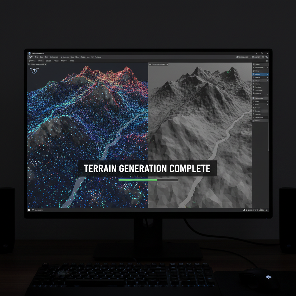
At its core, volumetric analysis in civil engineering quantifies the amount of soil moved to transform natural terrain into a construction-ready site. The workflow defines Drone Quantity Surveying'Cut' as the volume of soil or rock that must be removed from areas where the natural terrain exceeds the proposed design level. Conversely, 'Fill' represents the volume of material required to raise low areas to the necessary grade. The goal is to achieve a precise final grade that ensures structural stability and proper drainage across the site.
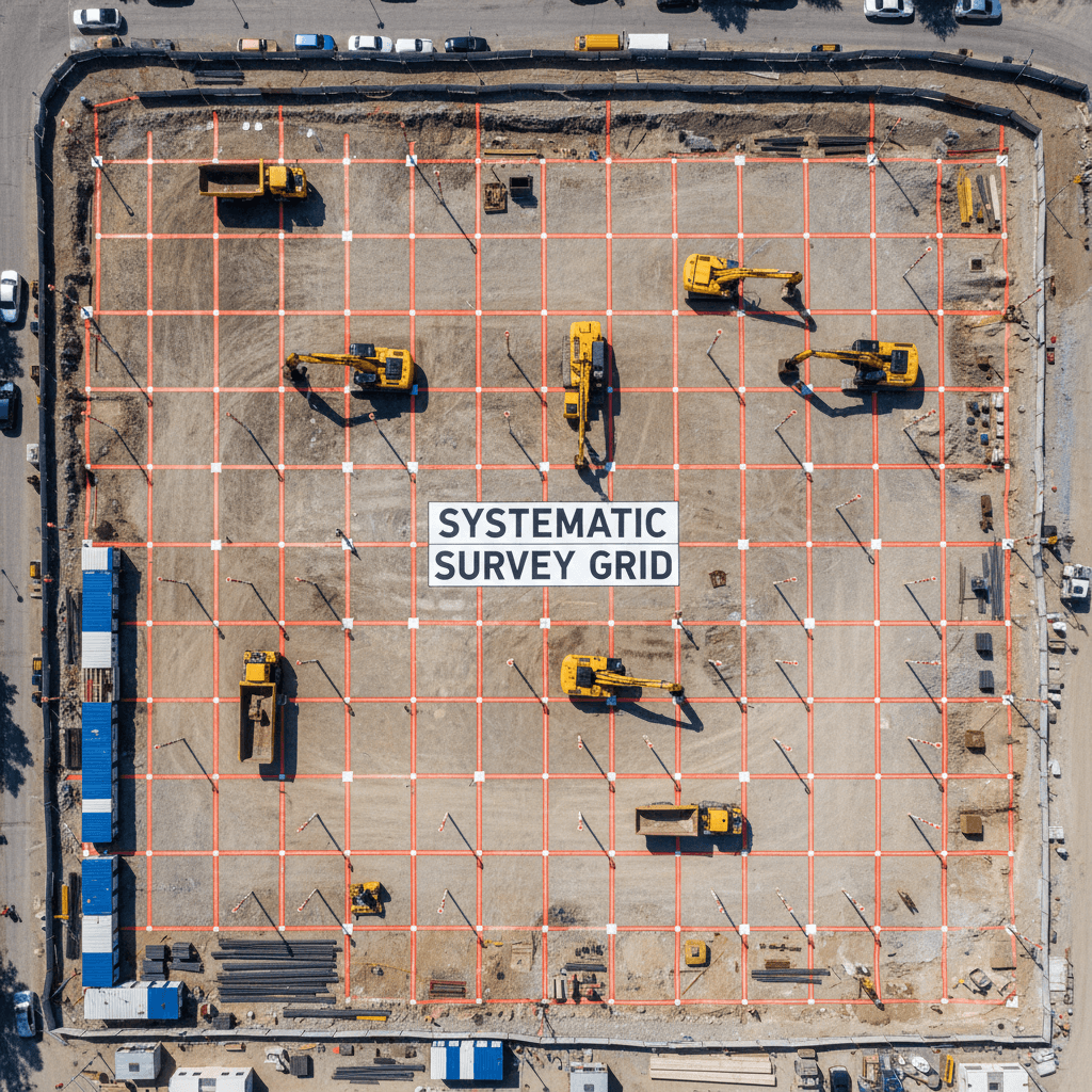
The fundamental logic of drone earthworks quantity surveying in Saudi Arabia relies on comparing two distinct surfaces. First, Majed Aerial Solutions uses high-resolution photogrammetry to create a Digital Surface Model (DSM). This model acts as a continuous, high-density representation of the existing terrain, capturing millions of coordinates (X, Y, and Z). Second, this model is digitally overlaid onto the project's design CAD file, typically a Triangulated Irregular Network (TIN) provided by project engineers.
Term | Technical Definition | Volumetric Impact |
|---|---|---|
Cut | Material removal above design grade | Surplus material for transport or on-site reuse |
Fill | Material placement below design grade | Requirement for imported or relocated material |
Net Volume | The mathematical difference between total cut and total fill | Determines the project's mass haul balance |
By subtracting the design surface from the drone-generated DSM, software calculates the volumetric difference with precision. This method replaces the sparse points of Precision Topographic Surveystraditional surveying with a comprehensive quantity calculation that accounts for every minor undulation in the terrain. The resulting data provides a net volume figure that tells project managers whether a site is 'balanced' or requires material import/export—critical for logistics planning in the Kingdom's vast development zones.
Accuracy Standards: RMSE and Volumetric Precision
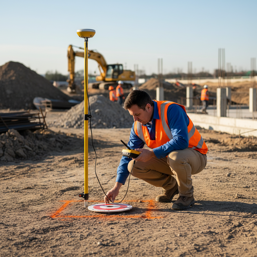
Engineers and project managers frequently ask: 'How accurate is a drone survey?' In the context of Saudi Arabia's vast infrastructure, the answer determines the entire project's budget viability. Majed Aerial Solutions adheres to rigorous accuracy standards, achieving a Root Mean Square Error (RMSE) of ±1 to 3 cm. This level of precision is achieved by combining high-resolution photogrammetry with the strategic placement of Ground Control Points (GCPs) across the site, which are surveyed with high-precision GPS to verify the drone's spatial data.
This vertical accuracy is the foundation for precise quantity surveying. By reducing vertical error to 3 cm or less, the resulting volumetric calculations typically fall within a 1% to 2% margin of error. For the demands of drone earthworks quantity surveying in Saudi Arabia on massive site grading projects, this precision represents a fundamental shift, providing a trusted dataset for both contractors and developers.
Metric | Drone Survey (Majed Aerial Solutions) | Traditional Point Survey |
|---|---|---|
Vertical Accuracy (RMSE) | ±1 – 3 cm | ±5 – 10 cm (Variable) |
Data Density | Millions of points per hectare | Hundreds of points per hectare |
Volumetric Margin of Error | 1% – 2% | 5% – 10% |
Terrain Capture | Continuous Surface (DSM) | Interpolation between sparse points |
The difference between these two methods comes down to data density. Precision Topographic SurveysTraditional surveyingDrone Quantity Surveying relies on a surveyor taking 'spot levels' at set intervals, such as every 5 or 10 meters. This method ignores subtle terrain changes between points, leading to significant interpolation errors. In contrast, drone surveying captures a continuous surface model that accounts for every mound, depression, and stockpile. On a project with millions of cubic meters, reducing the margin of error from 10% to 2% ensures every cubic meter of material is accounted for with mathematical certainty, preventing overpayment for phantom quantities.
How Precision Surveying Safeguards Your Project Budget

Data precision translates directly into financial control on the construction site. For drone earthworks quantity surveying in Saudi Arabia, developers rely on Majed Aerial Solutions to reduce the risk premiums often added to construction bids. By creating a high-fidelity digital twin of the site, developers can hold contractors precisely accountable for every cubic meter, ensuring the budget remains as stable as the foundation.
Four key business drivers illustrate how this accuracy protects the bottom line:
Precise Progress Payment Verification: Instead of relying on manual load counts or rough estimates, Drone Quantity SurveyingAerial Surveying
provides an objective measure of progress. Payments are disbursed based on verified volumetric change rather than projected timelines, ensuring the project's cash flow matches actual site reality.Dispute Resolution: Because our data is georeferenced and captured under GACA and GEOSA licenses, it serves as the definitive source of truth. If a subcontractor claims higher excavation volumes due to unforeseen subsurface conditions, our baseline and progress models provide the forensic evidence needed to resolve the claim quickly, avoiding formal arbitration costs.
Material Logistics Optimization: In Riyadh's diverse terrain, understanding the 'bulking factor' of excavated material is vital. Excavated rock and dense soil expand significantly when moved, a factor often underestimated in manual surveys. Accurate Precision Topographic SurveysDrone Surveying
allows managers to calculate exact truck cycles, preventing bottlenecks or unnecessary expenses from idle site equipment.Stockpile Management: Maintaining accurate quantity calculations provides real-time inventory of on-site materials. This prevents the over-expenditure of importing fill material when suitable surplus exists elsewhere on a vast giga-project site.
By measuring these variables with centimeter precision, project managers can eliminate the 'padding' typically found in excavation budgets. This level of oversight is critical in the Saudi context, where the sheer volume of material moved in projects like ROSHN or Diriyah means even minor errors in bulking factor calculations can lead to millions of Riyals in wasted logistics costs.
The Three-Phase Excavation Workflow
Implementing a standardized drone earthworks quantity surveying workflow in Saudi Arabia requires a disciplined three-phase approach to ensure data integrity from site mobilization to final handover. This framework provides the transparency needed for high-stakes projects across the Riyadh region.
Baseline Survey (Pre-Excavation): The most critical phase involves capturing the Original Ground Level (OGL) before any equipment arrives. This establishes the definitive starting point for all subsequent quantity calculations. Without an accurate, georeferenced baseline, estimating moved material becomes guesswork—the primary source of billing disputes. Majed Aerial Solutions uses Precision Topographic SurveysPrecision Aerial Mapping
to create a legally defensible digital 'Point Zero' for all parties.Interim Progress Surveys: Conducted at regular intervals, these flights track material displacement as it happens. These datasets allow project managers to verify contractor progress claims and monitor mass haul balance in real-time. By comparing these updates to the baseline, managers can spot quantity discrepancies early before they accumulate into major budget overruns.
Final As-Built Survey: Once excavation is complete, the final Drone Quantity SurveyingAerial Survey
verifies that the finished grade matches the engineering design files exactly. This ensures the site is ready for the next construction phase and provides a documented record for final account reconciliation.This structured Quantity Surveying
methodology eliminates the ambiguity caused by manual spot checks, providing a continuous audit trail that protects the developer, the contractor, and the project budget.
Drones vs. Traditional Surveying for Saudi EarthworksPrecision Topographic SurveysWhile the three-phase workflow provides the structure, the technology used to execute it determines the reliability of the output. Traditional surveying relies on a surveyor manually capturing spot levels with a Total Station or GNSS receiver. On a typical 100-hectare Saudi construction site, this might result in only a few hundred points. In contrast, Majed Aerial Solutions uses drone photogrammetry to generate high-density point clouds containing millions of coordinates. This granular data ensures that subtle terrain changes, often missed by manual interpolation, are included in the final volume.
Speed and safety are the primary operational drivers for adopting a drone earthworks quantity surveying approach in Saudi Arabia. A drone can survey 100 hectares in a matter of hours—a task that would take a traditional ground crew several days to complete. More importantly, it eliminates the need for personnel to navigate unstable slopes or walk near heavy machinery on site.
Feature | Traditional Total Station | Majed Aerial Solutions Drone Fleet |
|---|---|---|
Data Density | ~100 to 500 points per hectare | ~1,000,000+ points per hectare |
Site Coverage | Sparse interpolation | Continuous digital twin |
Survey Duration | Days or weeks | Hours |
Personnel Risk | High (Exposure to traffic and slopes) | Minimal (Remote operation) |
By choosing Drone Quantity SurveyingDrone Surveying over traditional methods, project managers receive a more comprehensive Quantity Calculation
without the logistical delays and safety risks associated with manual data collection. This efficiency allows for more frequent progress tracking, essential for the rapid pace of development in the Riyadh region.
Essential Deliverables for Quantity SurveyorsDrone Quantity SurveyingEnsuring data utility for a
Construction Project | requires delivering files that integrate directly into existing quantity surveying workflows. Majed Aerial Solutions provides a standardized package for every drone earthworks quantity survey in Saudi Arabia, starting with high-resolution orthomosaics and colorized heat maps that provide immediate visual auditing of excavation progress against design grade. | Deliverable Type |
|---|---|---|
File Formats | Primary Use | Volume Reports |
PDF, CSV, Excel | Progress payment verification and cost control | Surface ModelsPrecision Topographic Surveys |
DSM, DTM, LandXML | CAD design comparison and | 3D Data |
LAS Point Cloud, OBJ Mesh | BIM integration and Digital Twin development | Hydrology Data |
GeoTIFF, HEC-RAS ReadyThis structured Flood modeling and drainage analysis
These deliverables ensure that the Aerial Survey is not just a static snapshot but a functional engineering tool. Our data allows for seamless integration with HEC-RAS hydrology models—a critical requirement for infrastructure projects in flood-prone wadi areas across the Kingdom. By providing georeferenced, GEOSA-compliant datasets, we ensure every quantity surveyor in Riyadh has the evidence required to settle final accounts quickly and accurately.