HEC-RAS drone hydrology Saudi Arabia leverages high-resolution RTK surveying and LiDAR data to produce precise terrain models for advanced flood risk mapping. This methodology enables engineers to accurately simulate flash flood impacts on infrastructure projects across the Kingdom, ensuring superior reliability compared to traditional surveying techniques. By integrating drone-captured elevation data with hydraulic modeling, developers can optimize drainage designs and safeguard critical urban assets.
In Saudi Arabia, infrastructure projects often face a critical bottleneck when hydraulic models rely on coarse, outdated satellite topography. These low-resolution datasets fail to capture the subtle micro-topography of urban Riyadh or the complex drainage patterns of desert wadis, leading to inaccurate flood risk assessments and costly design errors. At Majed Aerial Solutions, we understand that reliable HEC-RAS modeling requires high-fidelity, drone-derived data to ensure structural resilience. This article explores how RTK-enabled aerial surveys provide the precision necessary for advanced hydraulic simulations. You will learn the technical differences between 1D and 2D modeling for local terrains; the step-by-step workflow from drone flight to HEC-RAS integration; and how to maintain compliance with GACA and GEOSA regulations. By shifting to high-resolution aerial hydrology, engineers can move beyond guesswork to build infrastructure that stands firm against the unique hydrological challenges of the Kingdom.
The High Stakes of Hydrology in Saudi Infrastructure Projects
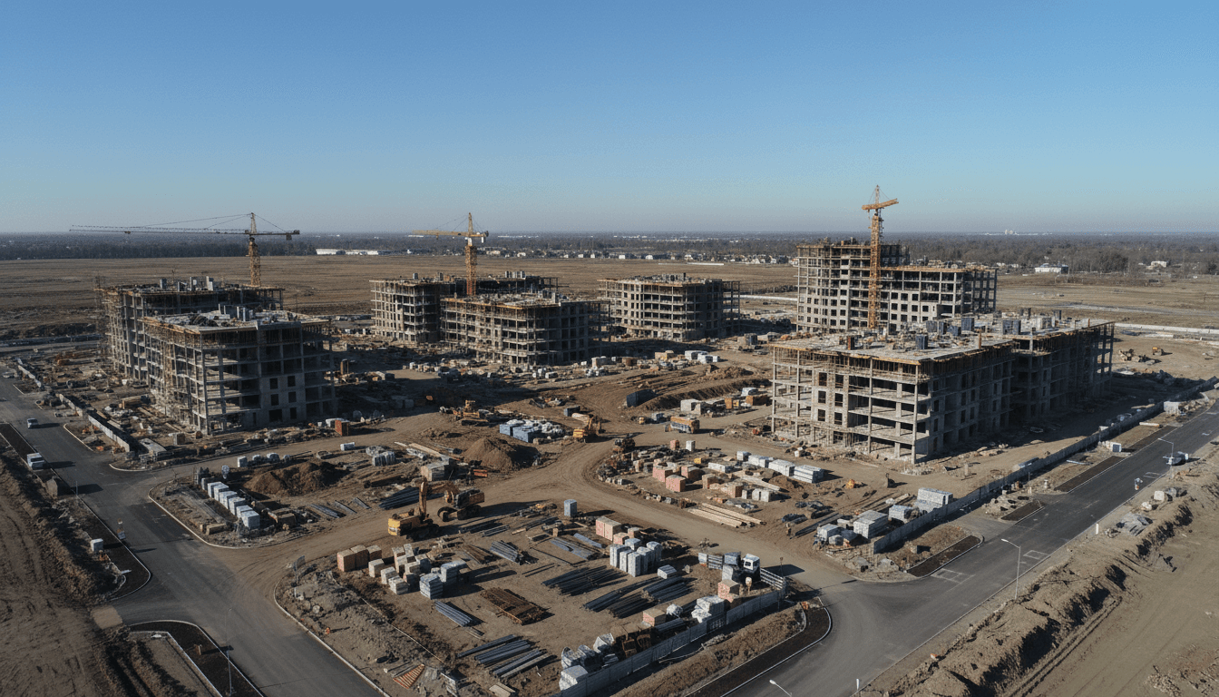
Infrastructure development across the Kingdom of Saudi Arabia is currently proceeding at an unprecedented scale. However, the arid geography of the region presents a deceptive hydraulic profile. While rainfall may be infrequent, the flash flood characteristics of wadi systems pose a severe threat to new developments. In regions like Riyadh or the burgeoning sites of NEOM, ephemeral watercourses can transform into high-velocity torrents within minutes of a storm event. As Vision 2030 accelerates urban expansion and the development of giga-projects, robust drainage design has evolved from a regulatory formality into a fundamental requirement for structural integrity and public safety.
Modern hydraulic engineering relies heavily on the Hydrologic Engineering Center's River Analysis System, commonly known as HEC-RAS. This software allows engineers to simulate water flow, map floodplains, and determine potential hazards with high precision. Despite its capabilities, the reliability of HEC-RAS outputs is inextricably linked to the quality of the input terrain data. Coarse topographic information can lead to catastrophic underestimations of water levels or diverted flow paths. This is why GIS and hydrology solutions have become indispensable; high-resolution elevation data is the only way to ensure these models reflect the true complexities of the Saudi landscape.
Majed Aerial Solutions bridges the gap between theoretical modeling and physical reality. As a GACA (UA-38575) and GEOSA licensed provider based in Riyadh, we specialize in delivering the high-fidelity data required for complex HEC-RAS drone hydrology Saudi Arabia projects. By utilizing RTK aerial surveying validated against physical ground control, we provide the sub-centimeter accuracy necessary to map wadi beds and urban catchments. Our professional drone fleet and dual licensing ensure that the geospatial intelligence we provide meets the rigorous standards required by the Kingdom's engineering, construction, and government sectors.
Why Satellite DEMs Fail Local Drainage Design

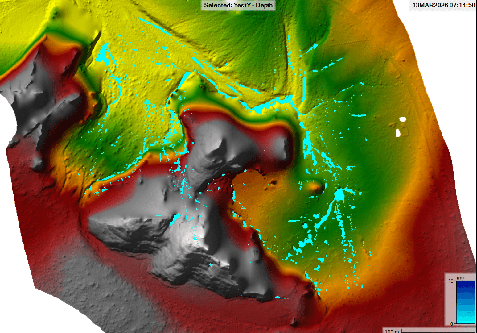
The effectiveness of HEC-RAS simulations is governed by the principle of "garbage in, garbage out." In many preliminary studies across the Kingdom, engineers rely on free satellite-derived Digital Elevation Models (DEMs) such as SRTM or AW3D30. While these datasets are useful for regional basin analysis, they lack the granularity required for site-specific drainage design. The primary constraint is Ground Sample Distance (GSD), which represents the distance between pixel centers on the ground. A 30 meter satellite GSD treats a massive area as a single average elevation, effectively smoothing over critical drainage features like curb heights, small embankments, or narrow wadi channels.
In contrast, our RTK aerial surveying delivers GSDs as low as 2 centimeters. This resolution captures the micro-topography that dictates exactly where water will pool or flow. The following table illustrates the stark contrast between standard satellite data and the high-fidelity outputs provided by our professional drone fleet.
Feature | Satellite DEM (SRTM/AW3D30) | Majed Aerial Solutions (RTK Drone) |
|---|---|---|
Horizontal Resolution (GSD) | ~30 Meters | 1 - 5 Centimeters |
Vertical Accuracy | ±3 - 10 Meters | ±1 - 3 Centimeters |
Micro-topography Capture | None (Generalized) | High (Curbs, Walls, Small Drains) |
Primary Application | Regional Watershed Mapping | Engineering & Construction Site Design |
Vertical accuracy is the most critical metric for HEC-RAS drone hydrology Saudi Arabia projects, particularly in the relatively flat terrain surrounding Riyadh. In these environments, a vertical error of just 10 centimeters can cause a hydraulic model to miscalculate a flood boundary by hundreds of meters horizontally. For a high-value real estate development or a critical utility substation, such a discrepancy is the difference between a safe site and a submerged asset. Coarse satellite data cannot differentiate between a flat plain and a slightly elevated pad, making it an unreliable foundation for high-stakes GIS and hydrology solutions where precision is a matter of safety and compliance.
HEC-RAS 1D vs 2D Modeling: Choosing the Right Approach for Saudi Wadis

The selection between 1D and 2D hydraulic modeling is a critical decision in any Saudi drainage study. 1D modeling is most effective for deeply incised, confined wadi channels where the flow direction is predictable and follows the primary axis of the stream bed. In these rural or mountainous corridors, the water is effectively contained within the banks, making cross-sectional analysis a reliable method for calculating water surface elevations.
However, many Vision 2030 sites are located on vast alluvial fans or within complex urban grids where 2D modeling is non-negotiable. These environments see water spreading laterally across the landscape, diverted by man-made structures and subtle natural ridges. A high-fidelity HEC-RAS drone hydrology Saudi Arabia study relies on a continuous, high-resolution terrain mesh to calculate these complex flow vectors accurately. Unlike 1D models that interpolate between surveyed cross-sections, 2D models compute flow across every cell in a grid.
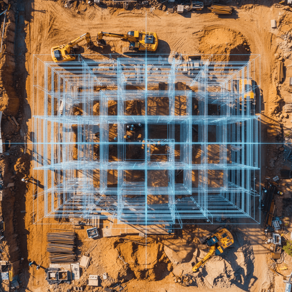
This level of detail is only possible through drone-derived data. Only RTK aerial surveying can capture the micro-topographical features, such as road curbs, site perimeter walls, and drainage berms, that dictate water movement in a 2D environment. Even a small 15 centimeter curb in a Riyadh industrial zone can redirect thousands of cubic meters of runoff, a detail that 1D models and satellite data completely ignore. By providing a dense, gapless Digital Terrain Model, we enable engineers to simulate how water interacts with specific building footprints and infrastructure, ensuring that flood mitigation strategies are based on physical reality rather than statistical averages.
Technical Workflow: From RTK Flight to HEC-RAS Integration

Converting high-resolution aerial data into a functioning hydraulic model requires a rigorous, multi-stage workflow. At Majed Aerial Solutions, we execute this process with a focus on geodetic precision and structural clarity, ensuring the data is ready for immediate engineering use.
The first phase involves an RTK aerial surveying mission. While RTK provides real-time kinematic corrections during flight, we validate every project using physical Ground Control Points (GCPs). These points are tied to the MTRF2000 datum, which is the standard for the Kingdom. This geodetic foundation prevents lateral or vertical shifts that would otherwise misalign the flood model with existing cadastral data or national infrastructure grids.
Once the raw imagery is captured, we move into photogrammetric processing to create a Digital Terrain Model (DTM). A critical step here is the classification and removal of non-ground features. In many Saudi landscapes, this means filtering out scrub vegetation, parked vehicles, and temporary site structures. For a successful HEC-RAS drone hydrology Saudi Arabia project, the model must represent the bare earth; if the software perceives a small cluster of desert shrubs as a solid topographical mound, the simulated water will divert unnaturally, leading to an inaccurate flood extent.
Following the terrain preparation, the workflow moves into the hydraulic environment:
RAS Mapper Integration: The processed DTM is imported into HEC-RAS via RAS Mapper. The sub-decimetric drone mesh provides the underlying grid for the hydraulic calculations.
Roughness Coefficients (Manning’s n): We utilize the high-resolution orthomosaic to help engineers assign Manning’s n values. This involves distinguishing between different Saudi land covers, such as high-friction desert silt and rocky outcrops versus low-friction urban asphalt or concrete drainage channels.
Hydrologic Simulation: The final step involves running flow simulations against specific return periods. In accordance with Saudi Ministry of Municipalities and Rural Affairs standards, we provide the data resolution necessary to model 50 year and 100 year storm events with confidence.
By integrating these GIS and hydrology solutions, we provide the high-fidelity terrain intelligence and categorized surface data required to produce defensible, safety-first flood risk assessments.
Urban Drainage and Micro-topography in Riyadh
In the dense urban grid of Riyadh, traditional survey methods often miss the subtle obstructions that govern local drainage behavior. High-resolution RTK aerial surveying identifies micro-topographical features like property boundary walls, elevated sidewalks, and small pavement depressions that function as unintended detention basins. These small-scale obstacles are the primary drivers of localized flooding in residential compounds and industrial zones across the Riyadh Province.
Integrating these high-fidelity findings into a HEC-RAS drone hydrology Saudi Arabia study allows developers to establish precise Finished Floor Elevations (FFEs). By accurately modeling how water interacts with specific building footprints and site grading, developers can ensure that assets remain protected during extreme rainfall events. Setting these elevations too low risks catastrophic property damage; conversely, setting them unnecessarily high significantly increases earthwork costs and complicates site access.
Our professional team provides the underlying terrain models and GIS and hydrology solutions required to populate these complex hydraulic simulations with real-world accuracy. It is important to emphasize that while Majed Aerial Solutions delivers the critical data and model inputs, the final determination of hydraulic adequacy and the formal certification of drainage designs must be performed by a licensed engineer of record. This synergy between advanced geospatial data and engineering expertise ensures that new developments in the Kingdom are resilient and compliant with municipal safety standards.
Compliance with GACA and GEOSA: Navigating KSA Drone Regulations
Securing high-fidelity topographic data is a technical achievement, but its utility in the Saudi Arabian market depends entirely on regulatory compliance. For any HEC-RAS drone hydrology Saudi Arabia study to be legally recognized, it must originate from an operator holding the correct credentials. The General Authority of Civil Aviation (GACA) oversees flight safety and pilot certification; Majed Aerial Solutions maintains GACA license UA-38575 to ensure every mission adheres to the Kingdom’s strict airspace protocols. Equally critical is the General Authority for Survey and Geospatial Information (GEOSA). GEOSA serves as the national authority for geospatial data, and only firms with their clearance can provide topographic models for official engineering use.
Utilizing unlicensed data introduces significant legal and financial risks. Municipalities and environmental agencies may reject studies during the Environmental Impact Assessment (EIA) or building permit phase if the underlying GIS and hydrology solutions were produced by an unauthorized entity. Furthermore, our GAMR registration (Reg. 646781) ensures compliance for all media operations. By choosing a dually licensed partner based in Riyadh (CR 7052338246), clients ensure their RTK aerial surveying is not only accurate but fully defensible before every regulatory body in the Kingdom.