Saudi projects move toward 3D digital twins when the scale and speed of Vision 2030 giga-projects exceed the capacity of traditional surveying methods. A drone-based reality-capture workflow lets teams compress data-collection time while maintaining survey-grade precision. The resulting models support complex site documentation, photogrammetry-to-BIM pipelines, and ongoing project monitoring.
Traditional surveying methods often struggle to keep pace with the construction timelines defined by Saudi Vision 2030. Site managers frequently work with fragmented data that no longer reflects current site conditions — a gap that drives costly delays and rework. Across the Kingdom's terrain and climate, manual total stations alone are increasingly insufficient for large-scale infrastructure. Modern projects need the throughput and precision of drone-based reality capture to stay competitive and compliant. This article examines the shift from conventional surveying to high-resolution 3D models and digital-twin workflows. You will learn the technical differences between RTK aerial surveys and manual methods, the role of thermal and multispectral data layers, and how to navigate the GACA and GEOSA regulatory framework.
The Evolution of Surveying in the Saudi Vision 2030 Era
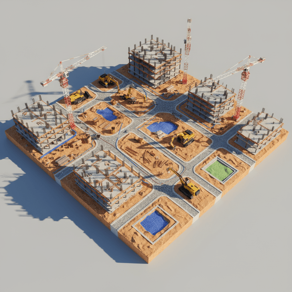
The construction landscape in Saudi Arabia is undergoing a structural transformation. Driven by Saudi Vision 2030, giga-projects such as NEOM and ROSHN — alongside infrastructure preparations for Riyadh Expo 2030 — are advancing at a pace that conventional methods struggle to match. Manual total stations and point-by-point ground GPS surveys laid the foundation for the Kingdom's earlier development, but the scale of current initiatives favours digital-first methodologies.
Capturing a site that spans hundreds of hectares using traditional methods can take months. Where rapid site validation drives engineering and investment decisions, that delay is increasingly unacceptable. This is where reality capture solutions become valuable. Using a professional fleet of specialised aircraft, teams can move from sparse, discrete measurements to dense, comprehensive datasets that cover the entire project footprint.
This technology is the primary engine behind the 3D models that Saudi developers use for real-time site insight. Through 3D photogrammetric modeling, developers can visualise and analyse assets in a virtual environment that mirrors site conditions with high precision. Applied correctly, this approach helps the Kingdom's most ambitious projects hold schedule while preserving data integrity for GEOSA-aligned deliverables.
Defining Reality Capture: More Than Aerial Photography

Reality capture is frequently mischaracterised as high-end aerial photography. In the context of Saudi industrial development it is a broader category of data-acquisition technology. Where photography records a visual moment, reality capture records the physical geometry and spatial relationships of a site. At Majed Aerial Solutions, we use our eight-platform professional fleet to move from taking pictures to capturing actionable geospatial data through 3D photogrammetric modeling.
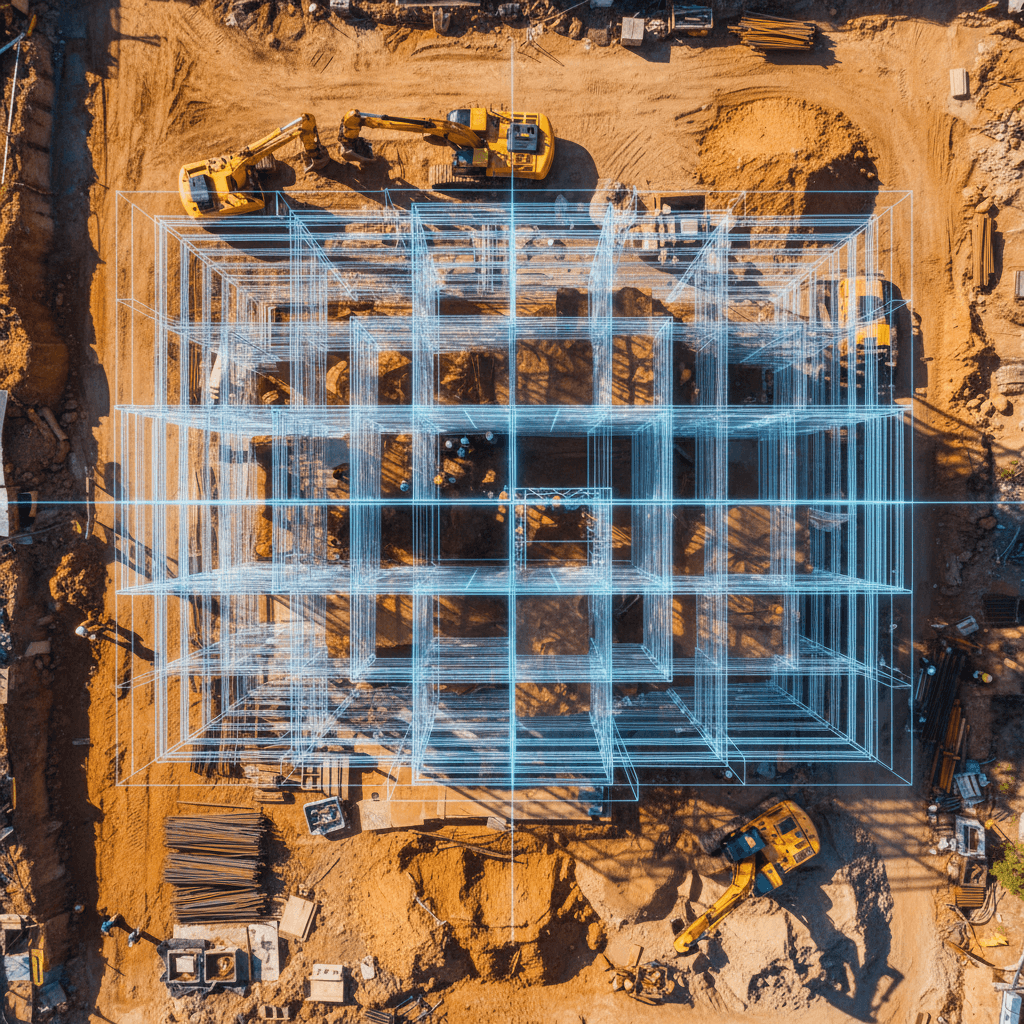
In a standard photogrammetric workflow, high-resolution sensors capture thousands of overlapping images, which are then processed to triangulate millions of individual points. The result is a dense point cloud — a digital environment in which measured points carry coordinate data. This is fundamentally different from the discrete, point-selective output of a total station.
Feature | Traditional Surveying | Drone-Based Reality Capture |
|---|---|---|
Data Density | Discrete points (sparse) | Millions of points (dense) |
Coverage | Selected points of interest | Complete site surface |
Visual Output | 2D CAD drawings | 3D models and digital twins |
Stakeholder Utility | Technical only | Technical + Cinematic 6K |
Traditional methods rely on a surveyor selecting specific points with a total station, which inherently misses the space between those points. A dense photogrammetric dataset gives developers a holistic surface model that point-based methods cannot provide. Our GAMR-licensed operations also let us supplement technical data with cinematic 6K aerial imagery, giving stakeholders high-fidelity visual context that bridges raw engineering data and executive-level presentation.
The Precision Gap: RTK Aerial Surveying vs Manual Total Stations
A common point of skepticism is whether drone data can match the precision of a total station. Traditional total stations offer sub-centimetre precision at individual points, but they are limited by the crew's ability to traverse terrain and record enough discrete locations. RTK aerial surveying narrows this gap by delivering high-density data across entire hectares at accuracy levels suitable for most engineering use cases.
At Majed Aerial Solutions, we use RTK (Real-Time Kinematic) technology to achieve approximately ±1–3 cm horizontal and ±2–5 cm vertical accuracy under typical conditions with proper ground control. The process relies on a continuous stream of satellite corrections between a base station and the aircraft, tagging each image with precise coordinates. This addresses the recurring question of drone-survey accuracy for earthworks and grading. For many large-scale Saudi infrastructure projects, drone-derived data is now a practical standard for rapid site validation.
Feature | Manual Total Station | RTK Drone Survey |
|---|---|---|
Typical Accuracy | Sub-centimetre (at point) | ±1–3 cm H / ±2–5 cm V (across site, with GCPs) |
Data Points per Hectare | Tens or hundreds | Millions (dense point cloud) |
Speed of Acquisition | 10 to 15 hectares per day | 200+ hectares per day |
Geometric Context | Linear/Vector data only |
Achieving survey-grade results in the Kingdom requires more than RTK hardware alone. We use physical Ground Control Points (GCPs) as an independent validation layer. These targets are measured with high-precision GNSS rovers and act as anchors that tie the aerial data to the local Saudi grid. Without validated GCPs, datasets can suffer from global drift and may be rejected at design-approval stages for government or municipal engineering. By combining RTK with GCP validation, we keep deliverables grounded in measured ground truth and aligned with the standards expected for Riyadh's urban expansion.
Why Digital Twins Matter for Modern Saudi Infrastructure

A standard 3D model represents a single moment in time. A digital-twin workflow extends that model into a data-rich, periodically updated representation of a physical asset. By feeding high-density point clouds and mesh data into Building Information Modeling (BIM) and Geographic Information Systems (GIS), reality-capture outputs become foundational engineering inputs rather than visual references alone. This lets Saudi firms move from visual inspection toward quantitative analysis, comparing as-built conditions against design data.
For firms managing large earthworks, this enables volumetric analysis on desert excavation. Instead of manual estimates, contractors can calculate material moved between capture cycles, supporting billing accuracy and schedule control. High-resolution terrain data also supports HEC-RAS hydrology modeling. Mapping flood risk in wadi systems is an important safety consideration for infrastructure near Riyadh, and high-fidelity topographic data provides the detail needed for planning-grade hydraulic simulation. (Certified flood studies require a licensed hydraulic engineer; our role is to supply the survey-grade terrain input.)
Application | Engineering Benefit |
|---|---|
BIM Integration | Clash detection between design and as-built terrain |
Volumetric Analysis | Cut-and-fill measurement for desert grading operations |
HEC-RAS Hydrology | Planning-grade terrain input for flood-risk and drainage modeling |
Stakeholder Access | Remote review with 360° immersion and 6K visual context |
This workflow also reduces the geographical friction inherent in giga-projects. Engineers based in Riyadh or Jeddah can conduct detailed remote reviews of sites located hundreds of kilometres away — taking measurements, checking progress against modeling benchmarks, and resolving conflicts without the delay of physical travel.
Decision Matrix: Traditional Surveying vs Drone Reality Capture
The right methodology depends on project scale and required data density. Reality capture offers a significant efficiency gain, but traditional surveying remains the standard for establishing legal property boundaries on small plots and for dense indoor environments where GNSS signal is obstructed. Manual methods provide the point-specific control needed for small-scale handovers and interior fit-outs where high-altitude line-of-sight is unavailable.
The balance shifts for large-scale topographic mapping, high-rise and structure inspection, and continuous construction-progress monitoring. For the Kingdom's giga-projects, acquisition speed is often the deciding factor. Drone-based reality capture can substantially compress survey timelines — industry implementations commonly report large topographic surveys moving from multi-month manual campaigns to a fraction of that duration, allowing teams to reach the excavation phase faster. Actual gains depend on site conditions, required accuracy, and deliverable scope.
Project Requirement | Traditional Surveying | Drone Reality Capture |
|---|---|---|
Legal Property Boundaries | Preferred for small urban plots | Suited to large-scale land verification |
Indoor / GPS-Denied Areas | Highly effective | Not currently offered (requires SLAM-based platforms) |
Topographic Mapping (100+ Ha) | Multi-month timeline | Significantly faster acquisition |
High-Rise & Infrastructure Inspection | Higher risk (scaffolding/access) | Safer, remote acquisition |
Data Density | Discrete points only | Comprehensive point clouds |
Specialized Layers: Thermal and Multispectral Reality Capture

Modern reality capture solutions extend beyond spatial geometry to data layers a total station cannot perceive. Using our professional fleet, we integrate radiometric thermal and multispectral sensors, turning a standard survey into a multi-dimensional diagnostic dataset.
In the energy sector, radiometric thermal inspection supports the Kingdom's large solar assets. Thermal sensors detect cell defects and hotspots that are not visible to the eye, helping operators address faults before they cause downtime. For real-estate developers in Riyadh, thermal data can indicate heat loss in building envelopes — a useful input for energy-efficiency assessment in the desert climate.
For urban greening initiatives such as Green Riyadh, multispectral sensors quantify vegetation health by measuring reflectance across specific spectral bands. This lets project managers monitor large-scale planting with measurable indices. Layered over 3D photogrammetric modeling, this produces a unified dataset spanning both the built and natural environment.
Navigating Saudi Regulations: GACA and GEOSA Licensing
Deploying reality capture solutions in the Kingdom requires adherence to a defined regulatory framework. Professional drone operations are a regulated activity overseen by the General Authority of Civil Aviation (GACA) and the General Authority for Survey and Geospatial Information (GEOSA). Majed Aerial Solutions operates under GACA Remote Pilot Certificate UA-38575 and GEOSA authorisation, with each flight documented and compliant.
These authorisations matter because they determine whether the resulting geospatial data is acceptable for government, municipal, and giga-project engineering. Without GEOSA authorisation and validated RTK aerial surveying practice, geospatial data may be rejected at design-approval stages. Our GAMR registration (Reg. 646781) additionally covers legal capture of high-resolution media used in 3D photogrammetric modeling and broadcast contexts. Partnering with a licensed provider (CR 7052338246) gives firms confidence that their geospatial deliverables meet the technical-accuracy and documentation standards expected on Saudi infrastructure programmers.
Choosing between reality capture and traditional surveying depends on your project requirements and goals. Traditional methods remain reliable for simple boundaries and constrained indoor work, while reality capture provides the density and speed needed for complex Saudi infrastructure. If you are looking to streamline your workflow through professional 3D modeling, our team is ready to assist — we help you identify the most efficient path for your specific site and scope.