Professional Aerial Solutions in Riyadh
6K aerial filming, RTK surveying, thermal inspection, and live broadcasting for engineering and construction projects.
Precision Aerial Solutions Engineered for Demanding Projects
We provide advanced, licensed aerial technologies for construction, engineering, and industrial sectors across Riyadh and the wider region.
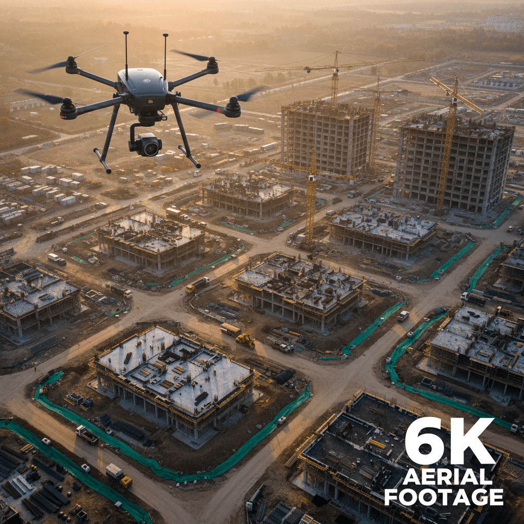
6K Ultra-High-Definition Videography
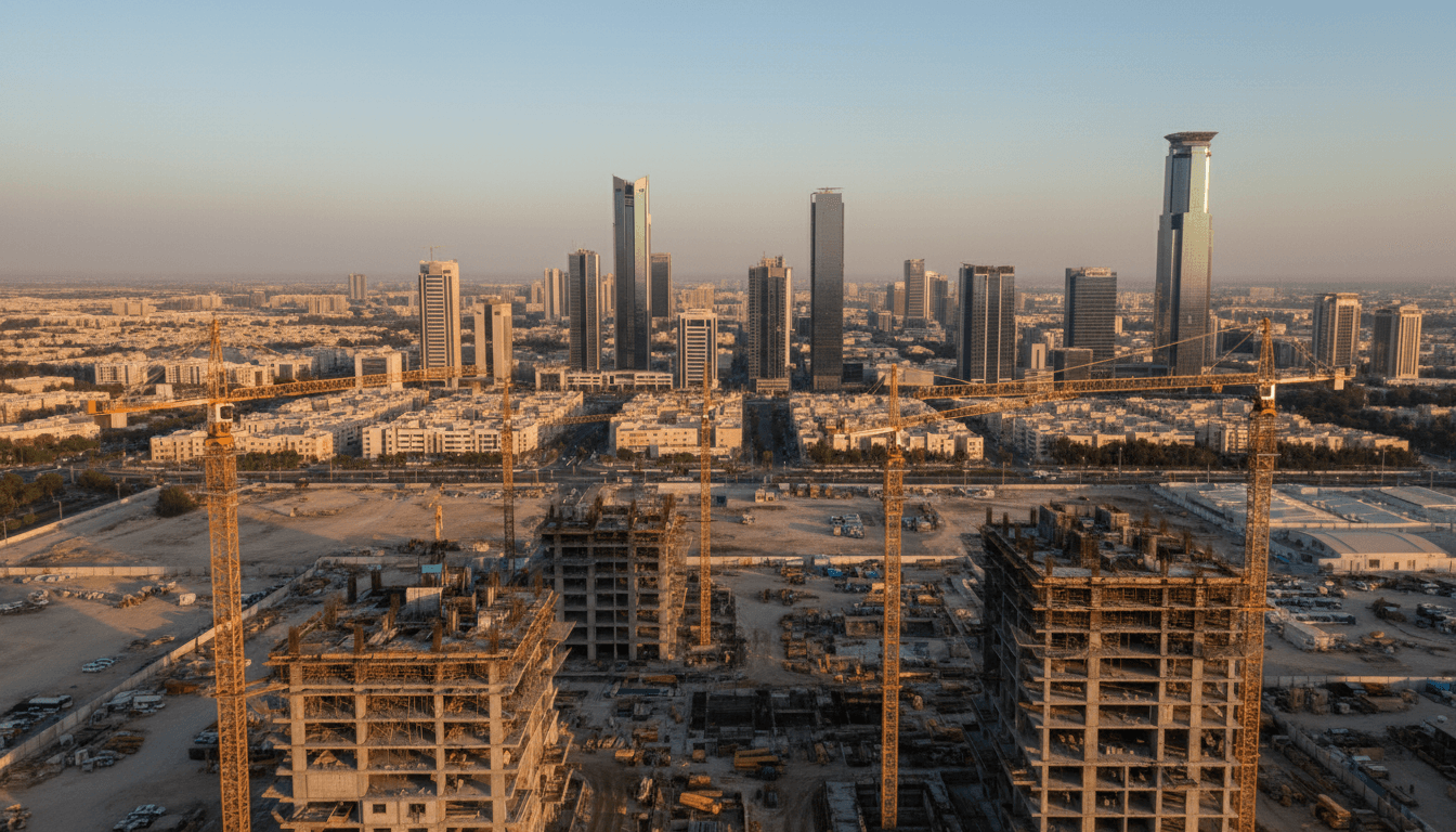
Professional 6K aerial videography capturing your projects with cinematic precision and exceptional clarity. Based in Riyadh and serving clients across Saudi Arabia and the wider Gulf region, Majed Aerial Solutions delivers licensed commercial drone video production built for construction documentation, real estate showcasing, industrial site monitoring, and corporate visual storytelling. Every flight is executed by a certified pilot using professional-grade equipment, operating within full regulatory compliance to ensure access to restricted and active project sites without disruption. Footage is delivered in high-resolution 6K, giving you the flexibility to crop, scale, and repurpose content across formats — from boardroom presentations to broadcast-ready productions — without sacrificing quality. Whether you need a single site captured or ongoing visual documentation across multiple phases, each shoot is planned and executed with the same standard of precision, frame by frame, site by site.
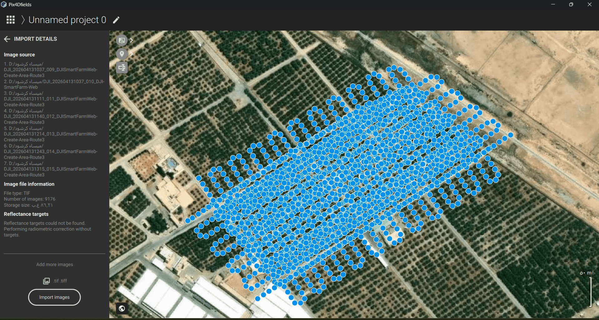
RTK Survey & Mapping
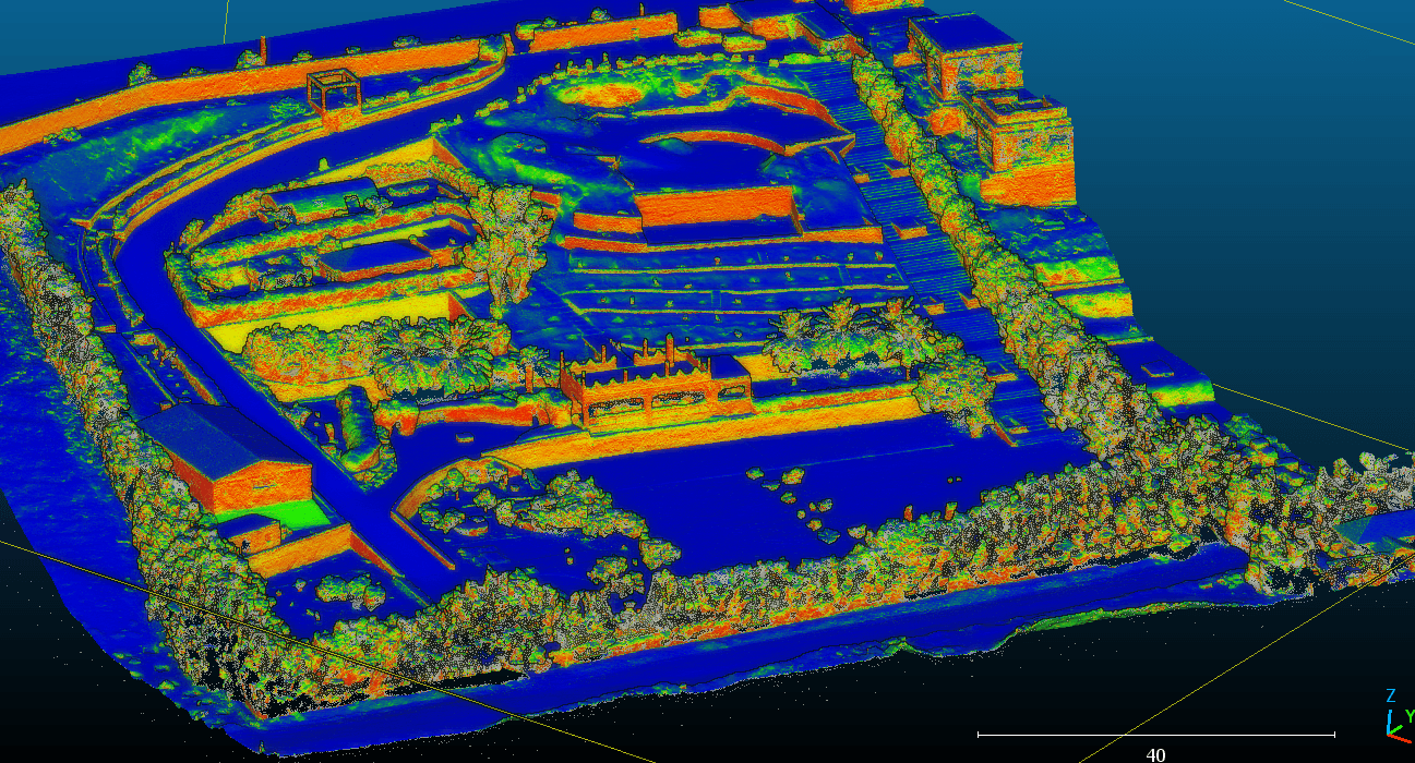
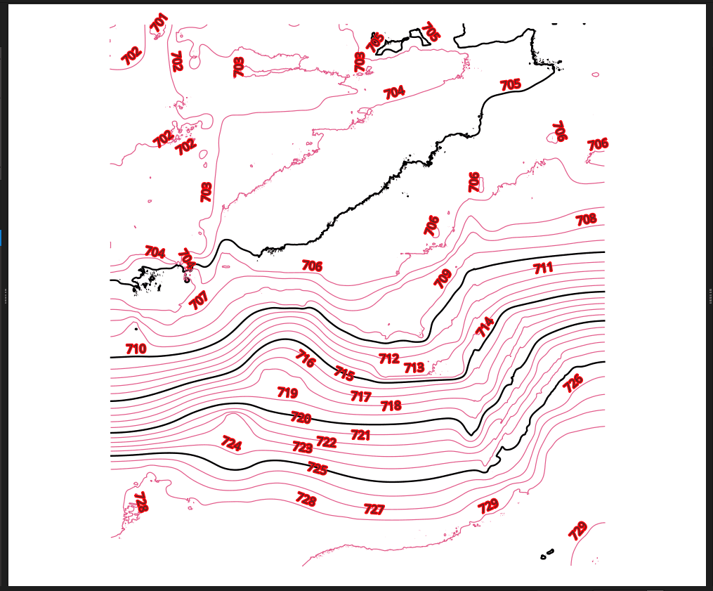
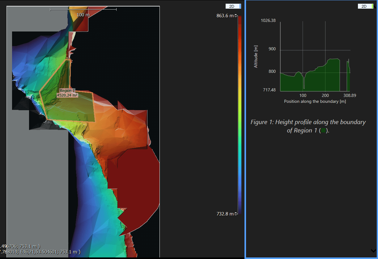
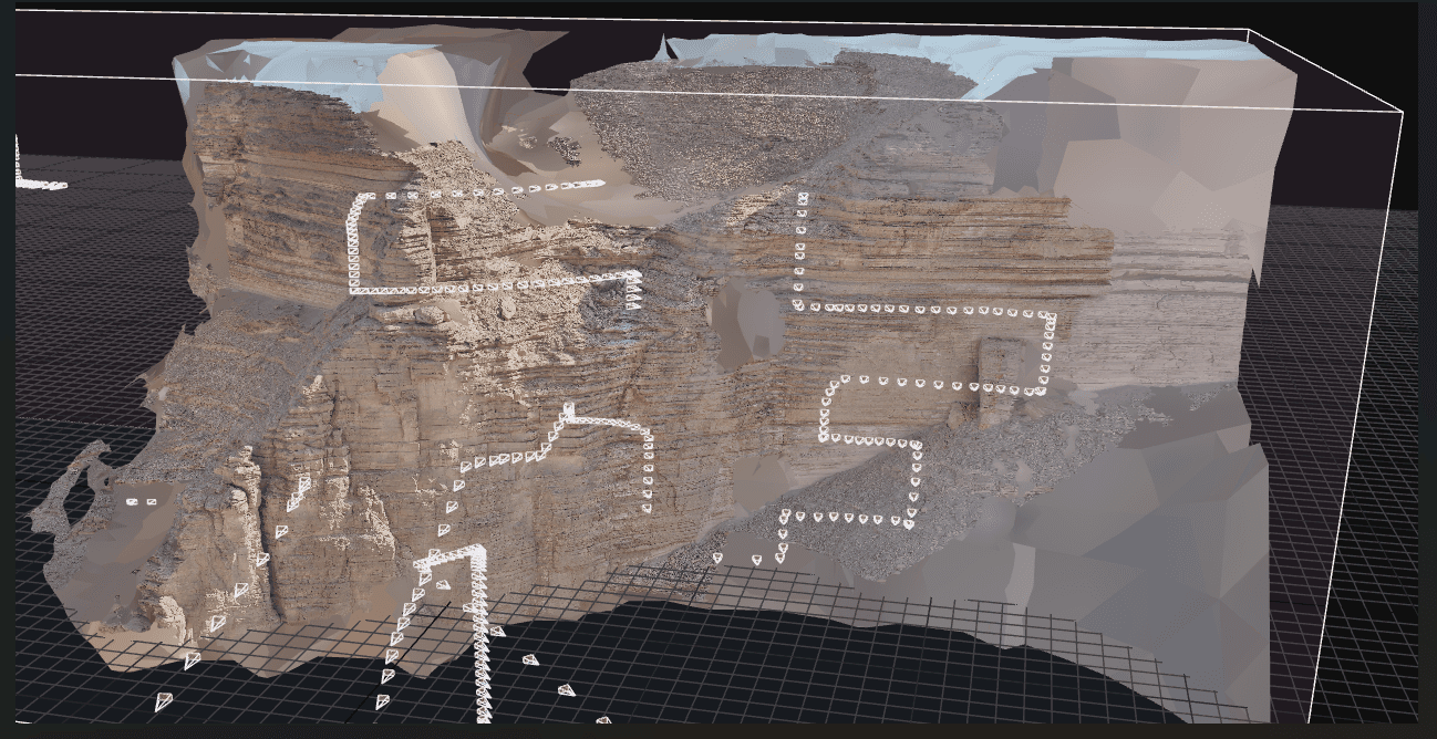
Delivering centimeter-level accuracy through advanced RTK drone technology, our mapping and surveying services produce high-precision GIS datasets and georeferenced outputs fully compatible with BIM platforms, CAD environments, and modern construction workflows. Every flight is planned and executed to capture reliable spatial data across large or complex sites, giving engineers, surveyors, and project managers in Riyadh and across Saudi Arabia the ground truth they need to make confident decisions — from early-stage planning through to final delivery.
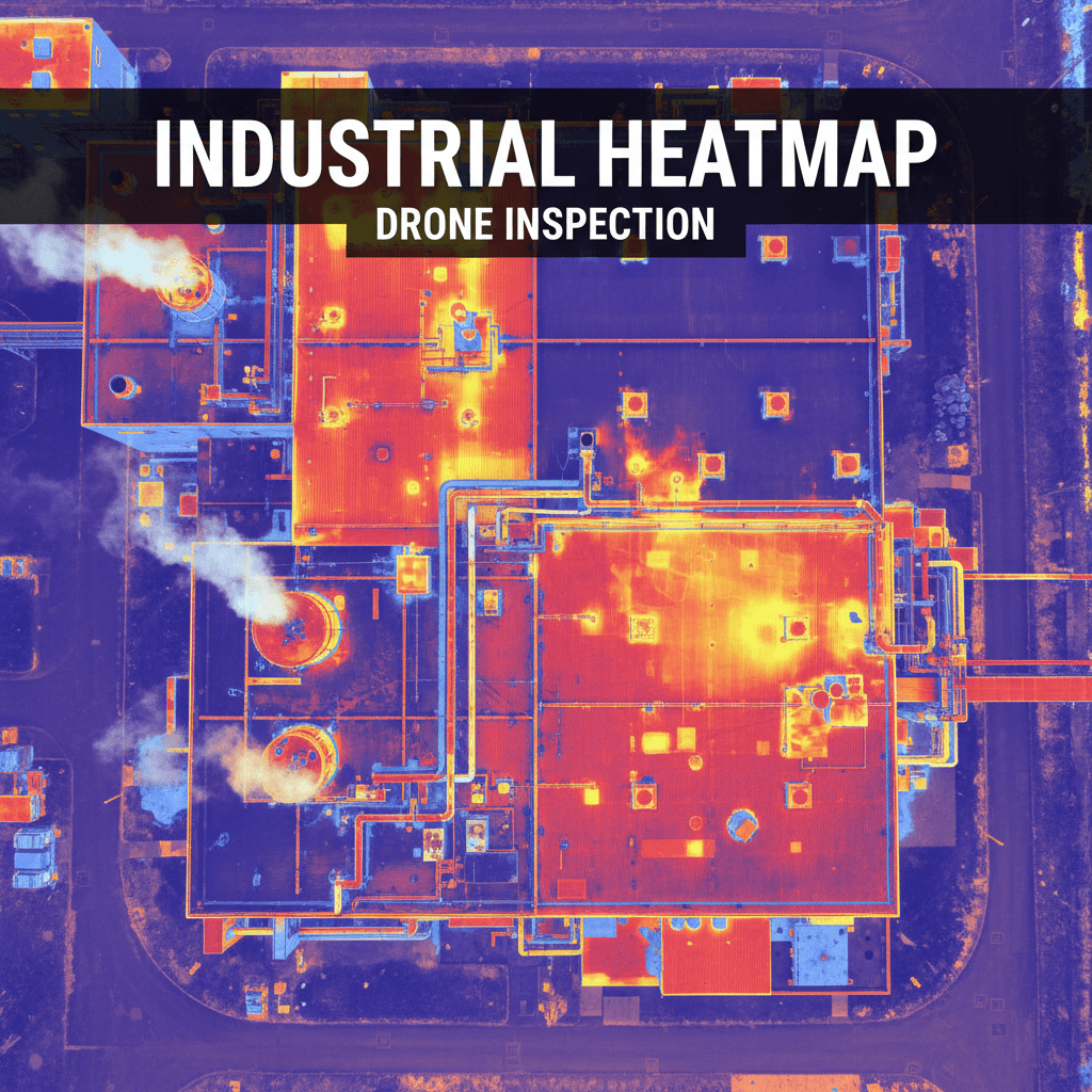
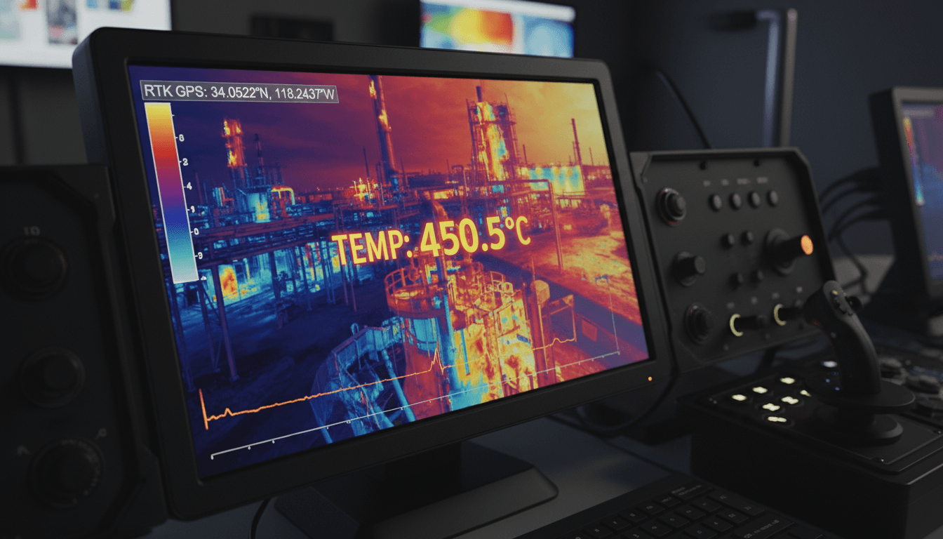
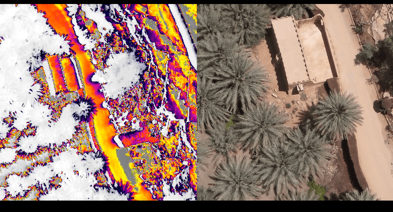
Thermal & Infrared Inspection
Identify structural weaknesses, thermal anomalies, and hidden leak points across your facilities with high-accuracy drone-based inspections. Majed Aerial Solutions delivers detailed aerial assessments across Riyadh and the wider Saudi Arabia region, capturing thermal and visual data that ground-level methods simply cannot match. Our inspections support asset maintenance planning, safety compliance, and infrastructure reporting for commercial, industrial, and government facilities throughout the Kingdom.
Live Aerial Broadcasting in Professional-Grade Quality
Majed Aerial Solutions provides professional live aerial broadcasting services across Riyadh and the wider Saudi Arabia region, delivering high-definition real-time video coverage from the sky for events, construction milestones, public gatherings, sports activations, corporate productions, and large-scale industrial projects. Using advanced drone systems equipped with high-resolution cameras and stable transmission technology, we capture cinematic aerial footage and stream it live with minimal latency, giving your audience an immersive bird's-eye perspective that ground-level cameras simply cannot achieve. Whether you are organizing a major event in Riyadh, documenting a project across the Kingdom, or producing broadcast-quality content for media and television, our licensed drone operators ensure seamless, safe, and visually stunning live aerial coverage from takeoff to final frame.
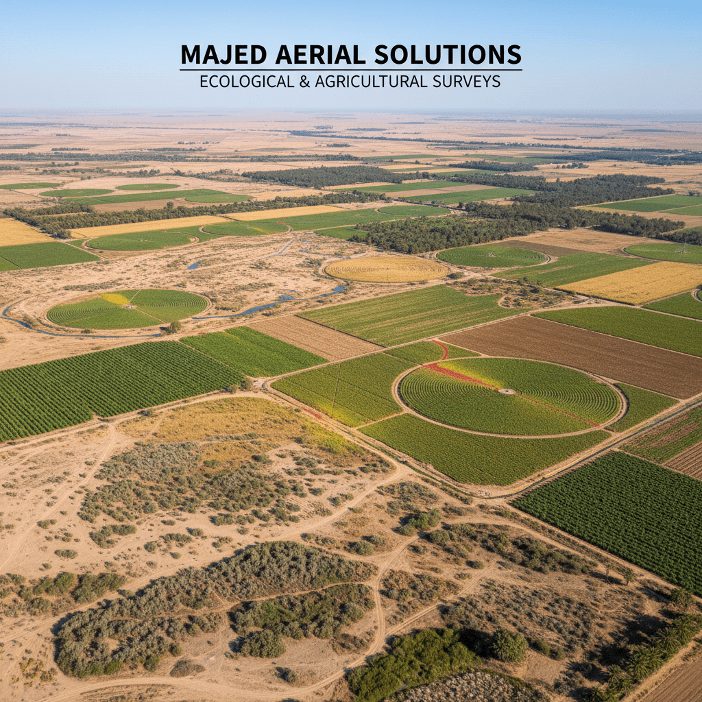
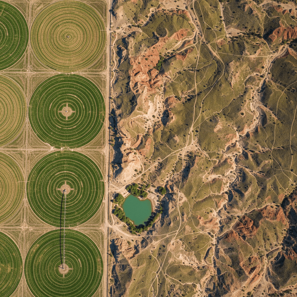
Ecological & Agricultural Aerial Survey
Majed Aerial Solutions conducts licensed drone operations across Saudi Arabia's diverse landscapes, delivering precision aerial intelligence for wildlife conservation and agricultural assessment. Leveraging 6K high-resolution imaging and thermal detection technology, each mission captures animal movement, population dynamics, habitat conditions, and crop health data with minimal environmental disturbance. Engagements are concluded with a comprehensive structured report encompassing species observations, thermal signatures, geo-referenced sighting records, and detailed habitat or field mapping — equipping conservation authorities, research institutions, and agricultural stakeholders with the verified aerial data required to make informed, confident decisions.
Aerial Projects Executed with Precision
Work we've done for clients in Riyadh — 6K aerial videography, RTK-precision mapping, and thermal inspection, all in one place.
Our Vision & Mission In Professional Aerial Services
Majed Aerial Solutions GACA licensed, precision aerial services across Riyadh and the region. We specialize in high-quality data capture for construction, engineering, and industrial projects — built for professionals who demand accuracy.
Do you have an aerial survey project?
Send us your project details and we’ll respond within one business day with a clear quote.
Address
Kingdom of 2353 Ali Ibn Muhammed Albatalusi, Tuwaiq, Riyadh 14927, Saudi Arabia
Get directions